

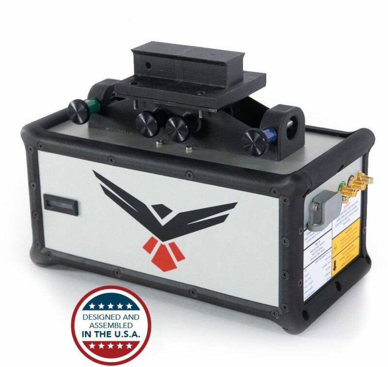
At the 2021 AUVSI XPONENTIAL Trade Show, currently taking place in Atlanta, Georgia, RedTail LiDAR has announced a new lidar sensor designed as a payload for small UAV/UAS applications. The RTL-450 weighs 4.2 lbs and incorporates a lightweight MEMS mirror and precision navigation system. The field of view is 40 degrees horizontal by 30 degrees vertical, with a maximum range of 100 meters, and range precision of 15mm. This provides an accuracy of 5cm at a 50 m flight altitude.
The RTL-450 is designed and assembled in the U.S., and incorporates patented LiDAR sensor technology. The LiDAR system is designed to operate independently of a drone platform, providing flexibility for drone integration. The modular nature of the sensor’s design facilitates efficient integration onto user-selected platforms. To date, RedTail reports that the RTL-450 has been integrated onto the FLIR SkyRaider, Freefly Alta-8, 4D-X6, DJI Matrice 300 and DJI Matrice 600, and the company offers
 One of RedTail’s goals with this system was to make the setup and flights of the RTL-450 easy to use. The setup is reported to take one person under five minutes, and flights are designed to be easily flown with only one user. Users can select their flight planning software based on personal preference, and the system is meant to be system agnostic - allowing customers to select their UAV of choice.
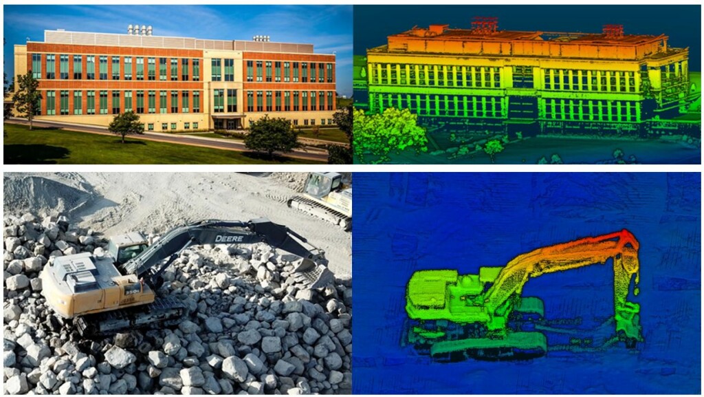
The system operates in a raster scan mode for surveillance missions and a side-to-side line scan mode for area mapping. The resulting point clouds – generated at a rate of up to 400,000 pulses per second and 5 returns per pulse – are well-suited to numerous military, first-responder and commercial applications, including mission planning, battle damage assessment, force protection, emergency response, remote surveillance, construction and resource management, and infrastructure development. One unique aspect of the payload setup is that all laser pulses are transmitted toward the ground toward the area of interest.
The fact that the 3D point clouds are created using the light from the pulsed laser also means that images can be collected both day and night. Receiving up to 5 returns from every light pulse transmitted enhances through canopy light transmission by allowing the ground to be imaged even under heavily foliated conditions – an important capability that cannot be provided by photogrammetric imaging techniques. The point clouds are processed with RedTail Point Cloud Generator software (RTP-PCG) and can be output as geo-referenced .las files.
The detail collected in the lidar images makes could also be high enough resolution for autonomous detection and classification of objects of interest, using AI or machine learning to remove humans from the normally time-consuming process - expanding the potential applications even further.


