Laser scan database on a smartphone to be demonstrated at SPAR 2011
HOUSTON—One of the more exciting technologies to be demonstrated here at the SPAR International conference in March takes advantage of one of the fastest-growing technology industries in the world: mobile devices.
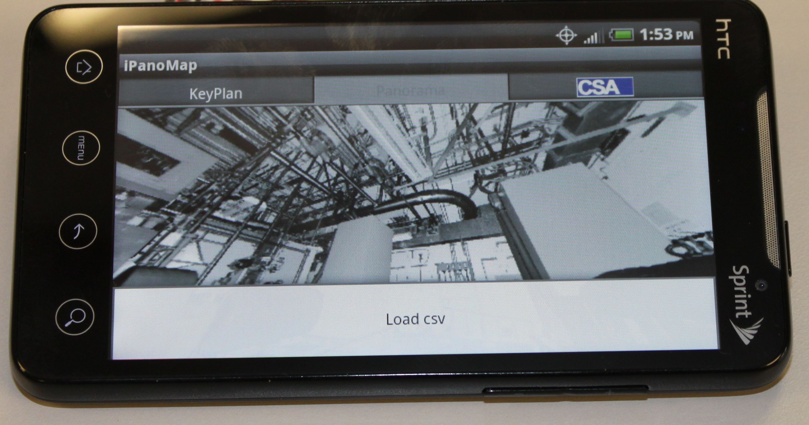
Amadeus Burger, of Construction Systems Associates, will be presenting CSA’s PanoMap application for the Android operating system, which can hold more than 1,000 360-degree scans and 3D CAD models merged into the scans.
“The user can navigate through the scan database in two modes,” Burger explains. “The first mode provides access through the keyplans, showing the location of scans by individual plant areas. The individual areas are identified by buildings, floors, zones, etc. The user selects an area in the keyplan, points to a scan, and the scan is displayed.”
The scans can also contain labels identifying equipment tags, radiation measurements, and other kinds of meta data.
“The second mode,” Burger says, “provides a plant walkthrough generated from individual scans. The walkthrough path can represent an inspection path, plant walkdown sequence, radiation survey path—it’s user-defined. The user can analyze the path on his computer or follow the path on his smartphone while in the plant.”
The possibilities for how this might be used in the field are still being developed, obviously, but Burger feels having scans available in this way can lead to better inspections, increased productivity by individuals not familiar with the plant, and improved training.
In the pipeline are capabilities like integrating images taken by the smartphone with the scan data, recording voice notes to attach to scans, and wireless transfer of data from the phone to and from external databases.
To get a full picture of the technology, attend the SPAR 3D’s SPAR International conference, happening in Houston March 21 through 24. For more information, visit www.sparconference.com.


