

When lidar sensors on consumer mobile devices became a reality this year (both in the iPad Pro and certain iPhone models), there were only a few companies who had already developed apps to take advantage of it for 3D capture – though many expressed interest. One of the more well-known companies to embrace this opportunity so far has been Pix4D, who have launched a new app – Pix4Dcatch – for 3D image acquisition that takes advantage of lidar sensors on devices like the iPhone.
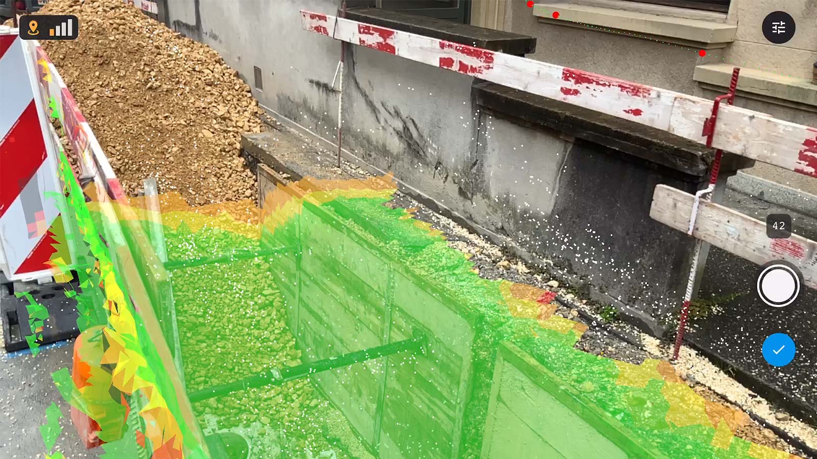
With this new app, users can now use these lidar-enabled mobile devices to create ground-based 3D models. The app records both images from the device camera and its GPS position. Compatible with recent iOS devices, but optimized for the newest iPad Pro and iPhone 12 Pro and Pro Max with LiDAR sensors, scanning is done with real-time 3D meshing for scene completion feedback.
Captured images can be automatically uploaded to Pix4Dcloud or Pix4Dmapper for a fast generation of scaled and georeferenced 3D models and points clouds that can be measured, shared and exported.
The creation of the app seems to be in line with the trend of major technology companies making companion apps (for example, Matterport Capture) or extensions of their software to work with devices their users may already have – for example, a phone or a tablet – rather than requiring the purchase of specialized, stand-alone devices.
Christoph Strecha, Founder and CEO of Pix4D talked about the increasing accessibility of 3D scanning.
“Until very recently, capturing accurate ground data for 3D modeling most often required specialized hardware or add-ons, as well as professional expertise. The strength of Pix4Dcatch is allowing anyone using consumer devices to easily acquire the right terrestrial data for digitizing the space around them and turn it into accurate 3D models. It is the missing link in data acquisition and complements Pix4D’s software solutions.”
He adds “In previous years, drones have become accessible to a big audience. In response, Pix4D innovated to release Pix4Dcapture, a free mobile app that quickly became a reference tool for drone mapping. Today mobile devices are not only high-quality image capturing tools but are also becoming professional measurement tools, enabling Pix4D to leverage their use to offer end-to-end workflows to our customers.”
Pix4D has positioned the new app as an expansion of their existing lineup of products, and a license for Pix4Dcloud or Pix4Dmapper is required to take full advantage of the application’s capabilities.
Pix4Dcatch is free to try. Download it now from the App Store.


