
Riegl rolls out new dual-channel laser scanner with ‘best-in-class’ multi-target capability, accuracy
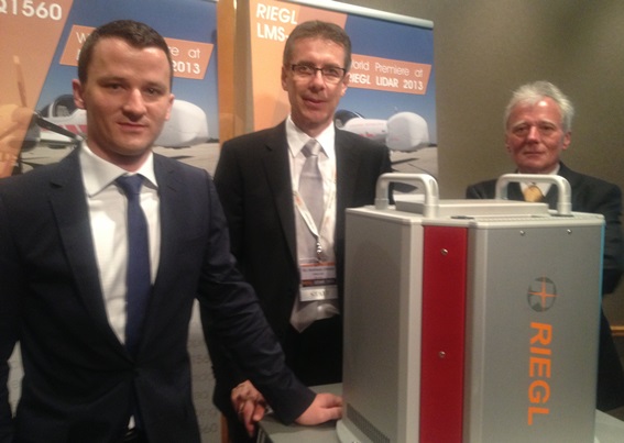
The RIEGL LIDAR 2013 user conference kicked off Tuesday in historic Vienna, Austria with the company introducing the LMS-Q1560 dual-channel, airborne laser scanner, claimed to have the highest point density and best point spacing in the marketplace.
Over 250 attendees, representing over 40 countries, gathered at the Vienna Marriott Hotel for the three-day event with more than 80 presenters discussing the latest in airborne, mobile, terrestrial and industrial lidar and its myriad applications.
Riegl Laser Measurement Systems, headquartered about an hour away in the town of Horn, “set the trend” of combining laser scanning and near range photogrammetry a decade ago, Chief Technology Officer Andreas Ullrich said in his keynote, calling it an “everlasting success story.”
Ullrich introduced the new LMS-Q 1560 compact laser scanner system for fixed-wing aircraft, which comes with an integrated high-performance IMU/GNSS system and 80-megapixel camera, with an optional second integrated camera.
It has “best-in-class” multi-target capability and accuracy using echo digitization and full waveform analysis/online waveform processing for data acquisition from all altitudes, Ullrich said.
Echo digitization and full waveform analysis is a measurement technique that helps deliver very precise digital elevation models from airborne lidar data with its “excellent” penetration of vegetation, Ullrich said.
Riegl was the first company to introduce a laser scanner employing echo digitization and full waveform analysis (offline) with its LMS-Q560 in 2004. These types of systems store digitized echo signals and scan parameters on a data recorder.
The new LMS-Q1560 is equipped with multiple-time around (MTA) capability, a technique where a laser pulse is emitted before the echoes of the last pulse have been received, resulting in a higher density of data acquisition, especially from high altitudes.
The scanner also has “forward/backward looking capability” using “smart orientation” of two 2D laser scanners.
Ullrich said the new system can take up to 800,000 measurements per second and averages about 543,000 measurements per second. It can scan 300 square kilometers per hour at a range of 2,000 meters flying at a speed of 110 knots.
New data recorder
To accompany the new system, Riegl introduced a new data recorder called the DR1560, which processes at 150 megabytes per second for each channel. It also offers a third channel for image storage.
The resulting accurate, low-noise point cloud, Ullrich said, has a “rich set” of attributes to improve post-processing, including calibrated amplitude, calibrated reflectance, radiometrically calibrated data set, and pulse width to improve classification.
For post-processing, Ullrich said a new version of Riegl RiANALYZE software will be introduced utilizing the “vast acceleration” of the data recorders’ GPU.
Ullrich called the LMS-Q1560 an “ideal solution for ultra wide area high altitude mapping,” including applications such as agriculture and forestry, shallow-water mapping, and city modeling, where it generates “a very complete data set even in narrow alleyways in urban areas.”
He said the scanner will soon have dual-wavelength capabilities.


