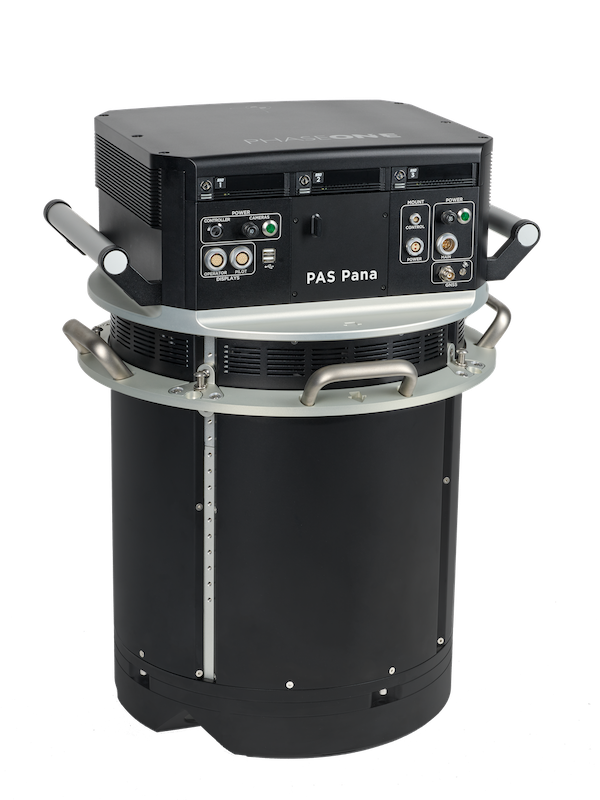
The PAS Pana is a seven-camera wide-field system that aims to redefine the landscape of aerial mapping precision and effectiveness. With a strategic configuration comprising five RGB cameras equipped with 150 mm lenses, and two Near-Infrared (NIR) cameras with 70 mm lenses, PAS Pana reaches a total swath of roughly 48,800 pixels across flight direction. This enables capturing a maximum area in minimal time, which makes data collection more efficient.
Together with an impressive range of high-resolution images that stretch from 2.5 cm Ground Sampling Distance (GSD) to 30 cm GSD, users now can cover the largest area with the lowest number of flight hours, while maintaining impressive image clarity based on their needs. A fact sheet with additional info is available here.
Applications and use cases
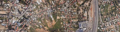
An online product brochure mentions some of the additional applications for which PAS Pana can be used, such as corridor mapping and 3D city modeling. Corridor mapping involves mapping and analyzing roads, rails and powerlines to take informed decisions, optimize operations and improve infrastructure management. Large area mapping is done for cadaster and land surveys, environmental monitoring and emergency response. Phase One’s 3D city modeling solution provides a GSD of less than 3cms, ensuring precise data acquisition without motion blur.
A Phase One customer’s unique need was the beginning of this latest innovation. The high resolution and sensitivity of the PAS Pana system provide the speed and performance to meet the ever-increasing requirements of Phase One’s clients. Over the years, the company has built a team of industry experts, backed by capable support group, ensuring efficient issue resolution.
PAS Pana is fully integrated with Phase One’s iX Suite which supports the mapping projects from planning to execution and processing. iX Suite consists of three products: iX Plan, iX Flight Pro and iX Process. IX Plan allows users to plan a project by defining the location, giving the requirements and selecting the system from the database. It automatically generates flight lines based on user information. iX Flight Pro offers one button click pre-flight check. iX Process allows users to review PAS image sets in full resolution without any image pre-processing steps, adjust the image radiometry and display the outcome in real-time.
Phase One A/S is a researcher, developer and manufacturer of medium- and large-format digital cameras and imaging systems. Founded in 1994, Phase One has pioneered the development of digital photography technology. Over the years, Phase One has grown to become a provider of high-end imaging technology across many demanding business segments, such as space imaging, aerial mapping, industrial inspection, and heritage digitization, as well as serving the world’s most demanding professional photographers. Phase One is based in Copenhagen, Denmark, and has regional offices in Denver, Cologne, Tel Aviv, Saku, Tokyo, Beijing, Shanghai, and Hong Kong.