
June 24, 2014 — Optech is pleased to announce that it will exhibit at AfricaGEO 2014 in Cape Town, South Africa on July 1-3. To learn what new Optech technologies are being deployed in Africa, visit our booth in Stands 7 & 8 in the exhibition hall, where Regional Sales Manager Fabrizio Tadina will be available to answer any questions attendees may have.
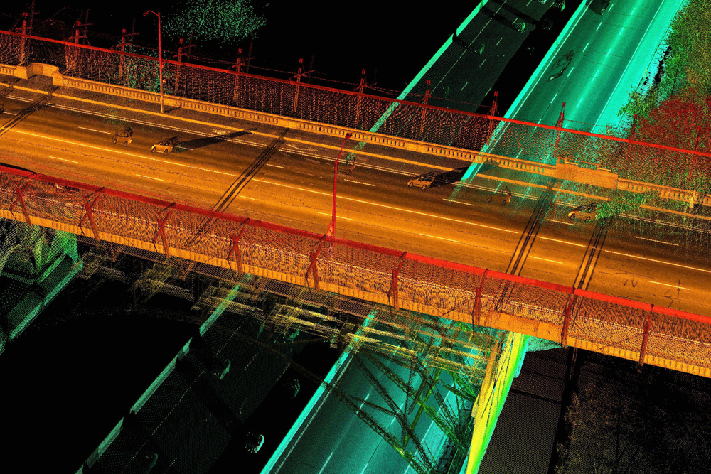
In addition to stimulating discussion and collaboration between its participants, this year’s conference is aimed at disseminating news about the latest surveying technology and the pressing issue of sustainable development. For this, Optech will discuss the two new variants of the Lynx Mobile Mapper™: The MG1 model operates from a compact installation footprint to deliver detailed mapping-grade 3D lidar data, while the SG1 model generates the high-density, survey-grade data needed for engineering projects. Both systems operate from vehicles traveling at highway speeds to enable surveyors to cover ground rapidly, and are compatible with the Point Grey Ladybug® 360° imaging camera.
Visitors interested in aerial surveying can learn about the unparalleled data quality and accuracy of the Optech Orion ALTM and find out which model is right for them: The C300 is perfect for low-altitude corridor surveying with its Class 1 eye-safe laser, while the low- to mid-altitude M300 can also handle urban modeling, engineering/transportation and small topographic surveys, and the low- to high-altitude H300 provides the maximum application flexibility. Meanwhile, those interested in surveying the truly wide areas of Africa can ask about the Optech Pegasus ALTM and how its dual lasers can efficiently cover targets like national parks or urban centers from high altitudes without losing point density on the ground.
All of these advanced sensors are unified by the Optech Lidar Mapping Suite (LMS), a truly revolutionary lidar processing workflow software designed specifically for high-volume large data processing. LMS users can survey from the air or the ground and efficiently process either type of data with the same software extremely quickly while maximizing the accuracy of the deliverables. For those needing even more accuracy and efficiency, LMS Professional consistently achieves high accuracy independent of the operator by automatically calibrating the sensors based on extracted features and by using advanced automated techniques to rectify the data.
About Optech
Optech is the world leader in high-accuracy lidar 3D survey systems, integrated cameras, and productivity-enhancing workflows. With operations and staff worldwide, Optech offers both standalone and fully integrated lidar and camera solutions in airborne mapping, airborne lidar bathymetry, mobile mapping, terrestrial laser scanning, mine cavity monitoring, and industrial process control, as well as space-proven sensors. Accuracy and productivity matter!


