
Hot on the heels of its newly released M6 6D-SLAM trolley-based lidar scanner, NavVis is offering a a new add-in for Autodesk Revit. The new add-in offers functionality for connecting Revit models to 360° data sets captured by NavVis scanners.
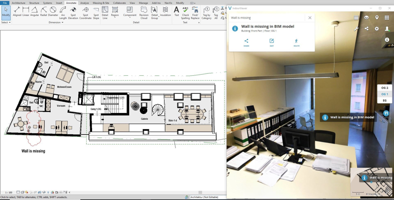
To use the add-in, users go through a simple step to align the models. After this, both the Revit model and the IndoorViewer file will display the same location simultaneously. Users can click on a location in the Revit model and immediately see it in the 360° capture, enabling easier cross-referencing during the creation and updating of BIM models.
NavVis’ new plugin helps users to spot changes to the building even while working from the office. The company also promises that the release will help overcome the issue of data silos and reduce errors in planning that result from outdated information.
The product is available as a standalone, or part of Autodesk’s AEC collection. See NavVis’ site for more information.


