Is stationary scanning becoming obsolete? How will the surveying business change?
AMSTERDAM—One of the topics that drew the most interest at the recently completed SPAR Europe conference, held here at the RAI Conference Center, was that of mobile scanning and mapping. What kind of accuracy can you expect? How fast can you drive? What’s the business case for collecting so much data?
In fact, keynote speaker Erik Siemer, general manager of M3DM, sparked discussion right off the bat with his presentation, which focused on the radical way mobile scanning can change the traditional surveying model. Now, he said, “we can do the same work that we used to do,” meaning traditional transportation-based survey work, “but there’s no work on the road. Even the control points were banned.” There’s no longer a reason to get out of the car at all.
Showing some of the results of M3DM’s scanning, Siemer noted, “you can even see the grooves in the asphalt.”
But the primary benefit of mobile scanning for Siemer is speed. He presented a case of scanning runway 6-24 for Schipol Airport. “It’s an ordinary three-point-five kilometer roadway,” Siemer allowed. “What’s very special about this project, though, is that what would have normally taken eight days to do by night at the airstrip – we managed to do the same thing in eight hours. And we even gave them extra information. We scanned the lights and some exits as well,” which resulted in the identification of some inaccuracies in the airport’s own internal maps.
This also points to one of the problems thus far with the mobile scanning market as it has developed—the customers don’t yet even know what’s possible. “The runway people don’t even ask for the lights because they think it’s too difficult,” Siemer said.
“It’s a big challenge that the customer’s expectations are too low.”
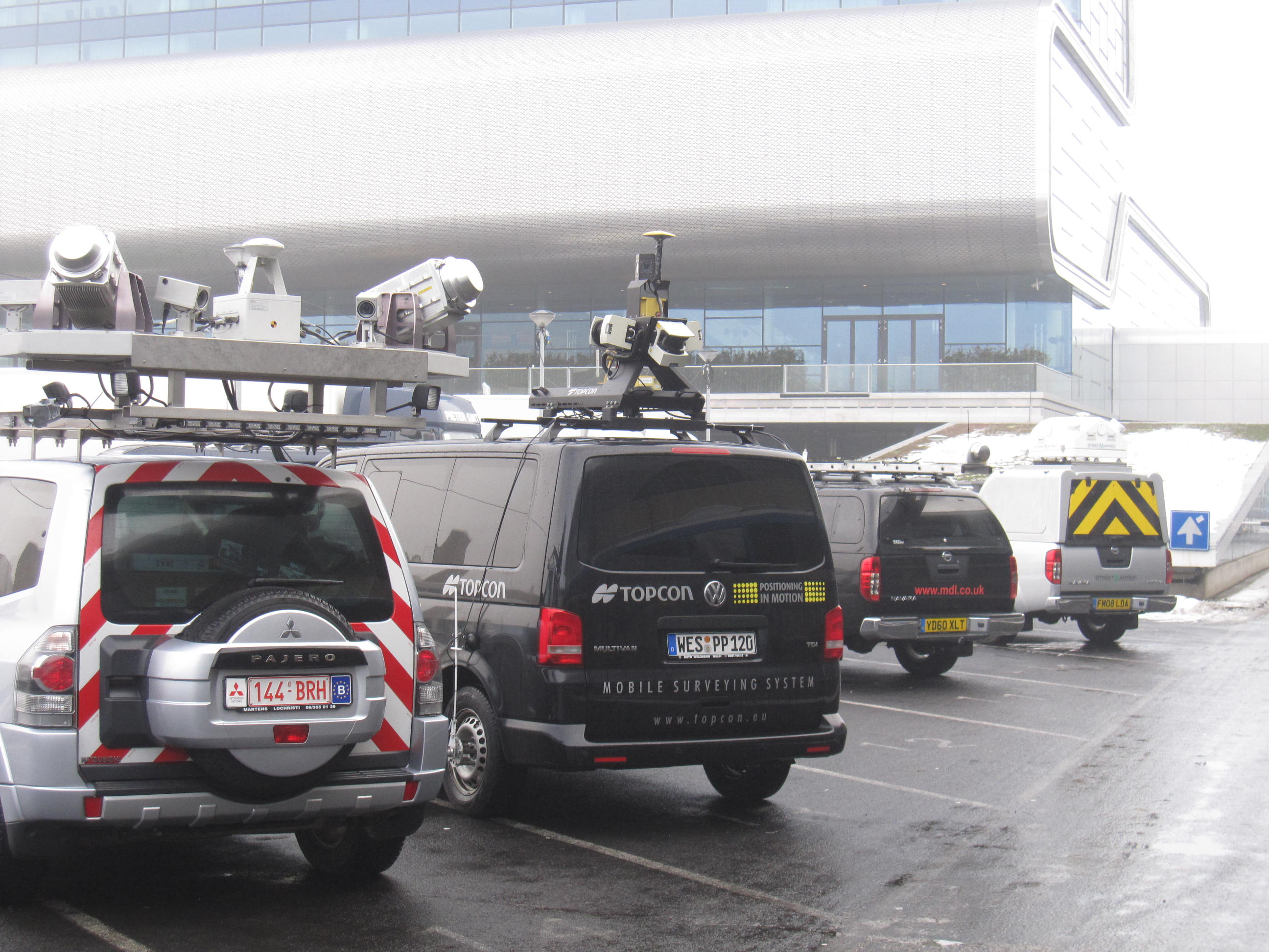
Those SPAR Europe attendees who were interested in mobile scanning could also get their hands on the equipment, as there were a number of mobile scanning vehicles parked outside the RAI, from manufacturers like Riegl, MDL, and Topcon, to service providers like Teccon and StreetMapper (one notable exception was Trimble’s demonstration vehicle, which was involved in an accident just previous to the show).
However, the limitations of mobile mapping were on display as well. The wet, foggy weather in Amsterdam at the time of the show made actually capturing data impossible.
Ray Mandli, president of Mandli Communications, has no shortage of mobile scanning vehicles. In his presentation on the first day of the conference, he presented some best practices for operating a mobile-scanning business and then presented a case study of capturing data for the Washington State Department of Transportation.
“We can take sensors from just about any discipline and integrate them into a mobile platform,” Mandlii said. He has an H2 that he uses for capturing data along rugged terrain, and once used a Mini Cooper, which he has now retired and operates as his personal vehicle.
He also noted he was forced to get into the software business: “When we got into mobile scanning, we couldn’t find anything that could handle all the points collected, so we created our own, called RoadView.”
To this point, Mandlii has collected more than 25,000 overhead structures, “and we’ll produce one million extracted assets by the early part of next year,” over the course of his roadway scanning, he said.
Mandlii also wanted to make note of the burgeoning secondary market for mobile scanning, coming from the gaming and entertainment world. “Two different special effects companies have come to talk to us,” he said.
However, there remains the question of accuracy. Even during the Washington job, where he slowed to 45 mph while he increased precision due to the job specifications, he found accuracy of “5 cm for monuments and extracted assets.”
Siemer stated that his system, with a 100Hz profiler from Z&F and QINSY software, could get data that’s accurate to 5 mm absolutely in the z coordinate (there are some who question that this accuracy is possible).
What will become standard for practitioners of mobile scanning is a question that will be answered as the market continues to develop.