
Geovap is a Czech firm that has been involved in surveying and processing of geospatial data since 1991. More recently, the company has launched the Quantum 3D project. In partnership with Optech, Pointools and Roadscanners, the company has begun combining point clouds from mobile mapping with data from ground penetrating radar (or georadar) for a complete road survey experience.
The net result has been some very useful results for Geovap’s clients, as Quantum 3D Project Manager Lukáš Vodehnal revealed at the recent Optech Terrestrial Laser Scanning User Meeting in Nice.
Vodehnal demonstrated how Geovap combined the different techniques on a survey of problematic sections of highways in the Czech Republic, saving the client time (a 90% saving in comparison with traditional survey methods) and money.
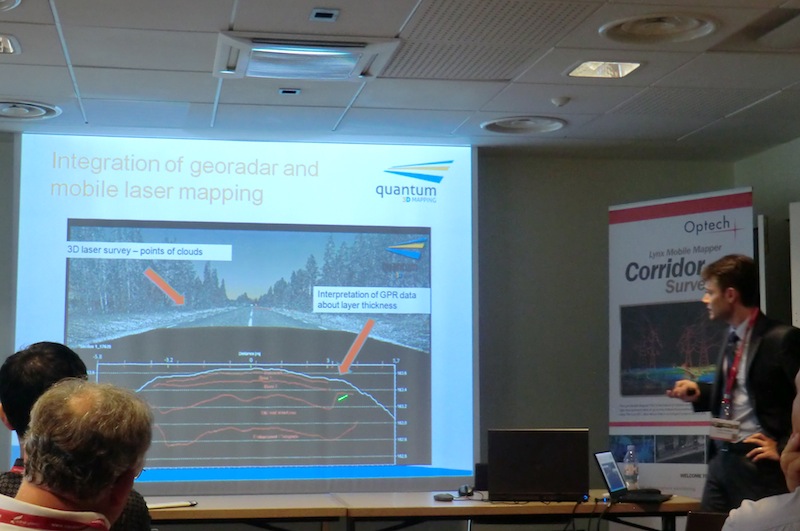
“Laser scanning gives you continuous information about the surface; georadar gives you continuous information about the structure inside of the body of the road. Together they give you ideal information for the reconstruction/design phase,” explained Vodehnal.
“You have to combine the two approaches, the two techniques, to understand what is the problem with the road. If you know what the problem is you can decide how to solve it for a quite limited amount of money,” he added.
The Czech survey involved driving along the highway in five different positions in each direction (to ensure full coverage of each three-lane carriageway). The Lynx M1 mapping vehicle was also equipped with a ground-coupled georadar and GPS coordinates were used to combine the data from the two sources. “Georadar is appreciated by the road maintenance companies because it gives the thickness,” said Vodehnal. He noted that for lower classes of road, where less accurate surface thickness data is required, air-coupled georadar can be used. This means the mapping vehicle can travel at higher speeds, reducing survey time further.
Geovap uses its own CAD software (Geostore V6) for the vector drawings. Clients can compare a digital terrain model of the actual surface of the highway with an ideal (totally smooth) DTM. This enables the user to clearly see depressions and bumps in the road surface. Having an ideal surface as a benchmark provides a more accurate picture than using design documentation, because “construction doesn’t always match design,” said Vodehnal.
Geovap’s services have been used to provide quality assurance in road construction projects (comparison to design and before and after scans for reconstruction work), as well as to enable preventive maintenance (surface deviation analysis, rut detection and frost-heave analysis are all possible).
The value to the client is clear: “Using these two techniques [mobile mapping and georadar]we are saving money for these projects,” concluded Vodehnal.


