
AURORA, Colo. – It’s no secret that energy conservation is a growing industry. For evidence, look only as far as U.S. President Barack Obama’s State of the Union address last night, where he said this: “I’m also issuing a new goal for America: Let’s cut in half the energy wasted by our homes and businesses over the next 20 years.”
In order to cut waste, though, one must identify it. That’s why the work being done by Bluesky, in the UK, to create residential thermal heat loss maps, shows promise, and that’s why Merrick has begun to create a business around combining LiDAR and thermal data collection (something blogger Ed Oliveras wrote about not long ago).
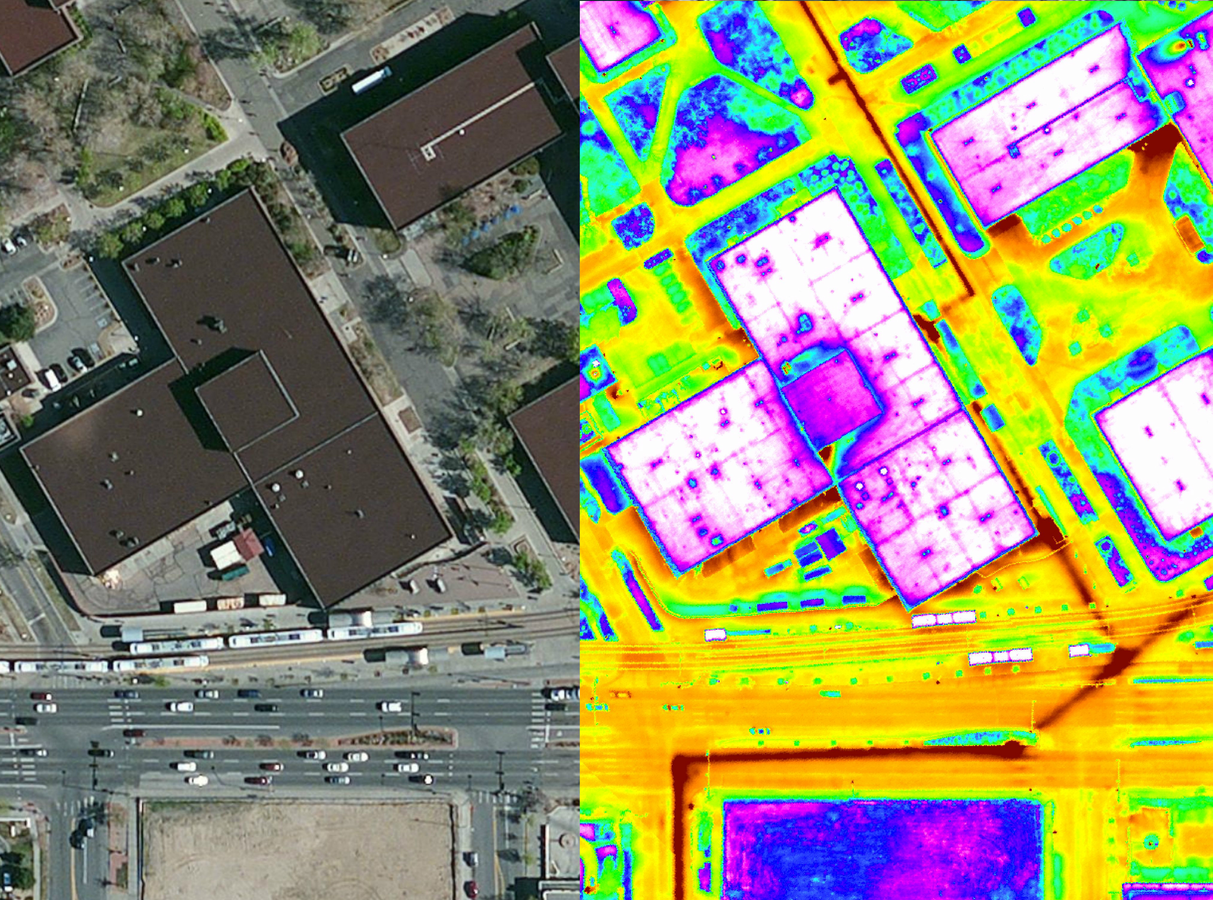
Merrick has always prided itself on its sensor integration, and this year, said Bill Emison, senior account manager at Merrick, the company has been flying lidar and thermal sensors together to help the likes of FE Warren Air Force Base identify heat loss and begin to rectify it.
“They wanted some new topos and some new surface models,” he said, “and then they spoke about the energy efficiency goals they had. So we pitched them on the thermal sensor. We hadn’t really done it in that kind of application before.” The Air Force, like the rest of the U.S. military, has a mandate for “Net Zero” energy use, essentially aiming for an ability to create on site as much energy as they’re using.
“That’s sprouted from the war effort overseas,” Emison noted. Supplying forward bases with oil and gas is both expensive and leaves the supply trains open to attack.
“And those folks follow orders pretty well,” Emison said. “If you tell them what they have to do, they figure out a way to do it.
Merrick leased a wide-array, internally cooled broadband thermal imager, the TABI-1800, from Canadian firm ITRES, and integrated that with its airborne lidar sensor and digital camera. That allowed the company with one flight to collect all of the data they needed to provide Warren AFB with the deliverables they were looking for, including the exact location of heat loss stemming both from building roofs and the base’s underground high temperature hot water distribution system.
Warren is now using that report to initiate a base-wide assessment and maintenance plan, Emison said.
It’s also worth noting that, while collaboration hasn’t quite come together yet, Merrick did purchase Energy Ace, an energy conservation consultancy firm, last year, and it would make sense to follow on work like the thermal analysis with a consultation on how to address the problem areas.
Long-term, Emison believes this kind of sensor integration will become more commonplace and bodes well for Merrick. “Forget about the platform,” he said. “It could be an aircraft or a helicopter, a bus, a train, a boat, even a UAV. The platform is irrelevant. Our approach is always a multi-sensor simultaneous collection from a single platform … The hardest part is how we produce the products and deliverables that our clients need.”


