
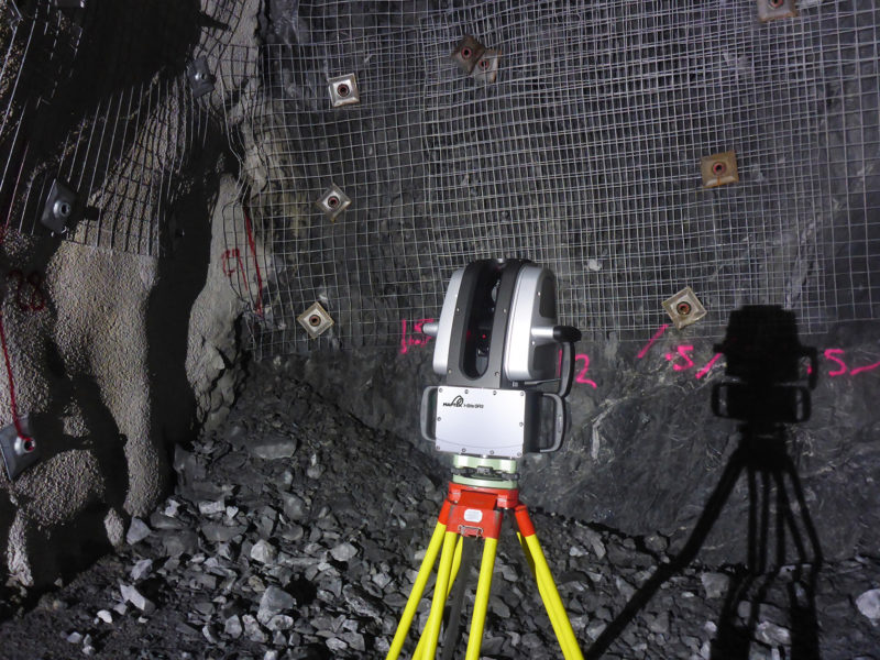
Maptek, largely known as a producer of 3D scanners for the mining industry, has released its first new lidar of 2018. The SR3, part of the R3 series of scanners, is significantly smaller, lighter, and faster than the vendor’s I-Site 8000 scanners.
The SR3 can be mounted on a tripod or a vehicle, weighs 9.6 kg, and boasts accuracy of 4 mm. It offers a scan window of -40° to 90° vertically, and a full 360° horizontally, making it ideal for “capturing all surface in any direction without the need for complicated configurations.” An automated leveler in the scanner solves orientation issues by correcting scans before processing.
Maptek’s new SR3 includes a number of other novel features. It allows the operator to queue multiple scans, and import mine CAD strings to view together with scans for quick, real-time comparison between models and the current condition of the mine.
“The positive experience from a fairly routine job to create a 3D map of an underground mine,” says mine measurement product manager James Howarth, “builds confidence in the system for additional applications using the data captured. This adds value for critical tasks such as change detection, calculating volumes of materials removed from drifts, and design conformance.”
For more information, see the product site here.


