
TopoDOT compatibility adds ‘significant value’ to Bentley’s POD users, says Ted Knaak
Certainty 3D, LLC said Monday its TopoDOT lidar point cloud processing software can now extract high quality 3D models and topographies from Bentley Systems POD files.
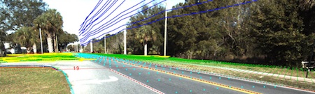
Orlando, Fla.-based Certainty 3D said TopoDOT is a MicroStation CAD software application for importing and extracting topography and models from point clouds, calibrated images and related data. It is already compatible with many proprietary system formats and open formats such as LAS and ASTM E57, Certainty 3D said.
With the addition of Bentley’s POD data format to the list of compatible formats, Bentley users can exploit POD’s current large data set capability, and soon to be introduced data management tools being implemented in Bentley’s Projectwise software suite.
“TopoDOT’s compatibility with Bentley’s POD format is just another example of the value and importance of open formats to the lidar community.” said Ted Knaak, president of Certainty 3D. “Bentley should certainly be commended for their improvements to the application programming interface capability associated with POD making this compatibility possible. TopoDOT compatibility definitely adds significant value to Bentley’s POD format.”
Certainty 3D also sells TopoPLANNER and TopoMISSION laser scanning project planning tools and consulting services for laser scanning technology.


