
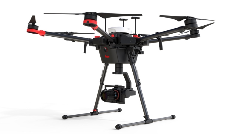
At this year’s HxGN Live, Leica Geosystems announced its latest UAV, the Leica Aibot. The UAV is a multi-rotor airframe based on DJI’s aerial platform, the M600 Pro, and is designed for fast acquisition of 3D mapping data.
The solution is fully integrated with Leica Geosystems’ current suite of software solutions, including Cyclone and Cloudworx. Leica says that users can leverage Leica Infinity for point cloud, surface model, and orthophoto generation for current workflows in construction and surveying.
On the official product website, the UAV is listed in two variants, the CX for construction, and the SX for surveying.
The Aibot offers what you would expect, including GPS and RTK, and an average flight time of 24 minutes, and 160 acres of coverage. It folds down to 540 x 582 x 632 mm, and weighs 9.1 kg. It can handle a maximum payload of up to to 6 kg. The available sensors include the full-frame Sony aR7II and the APS-C mirrorless a6300.
For control, the system features the skyCAPP flight execution app, which was designed specifically for the Aibot. Run on a tablet, it enables the user to manage the mission during flight execution, with two views, one that show real-time feedback from onboard cameras, and another that shows a map view. Other features include mission-pausing and battery life management.
For more information, check Leica’s official product site.


