
Though the Pegasus:Multiscope might have been the flashiest new product released at last week’s HxGN Live conference, it wasn’t the only new capture product on hand. Leica Geosystems also announced the CityMapper airborne solution, which combines cameras and a LiDAR unit into a single pod. Leica calls this combination a “fused airborne sensor.”
Technically, the CityMapper pod consists of three separate sensors: a Leica RCD30 CH82 multispectral camera for capturing nadir imagery, a Leica RCD30 CH81 camera for capturing oblique imagery at a 45° angle, and one Leica Hyperion LiDAR sensor.
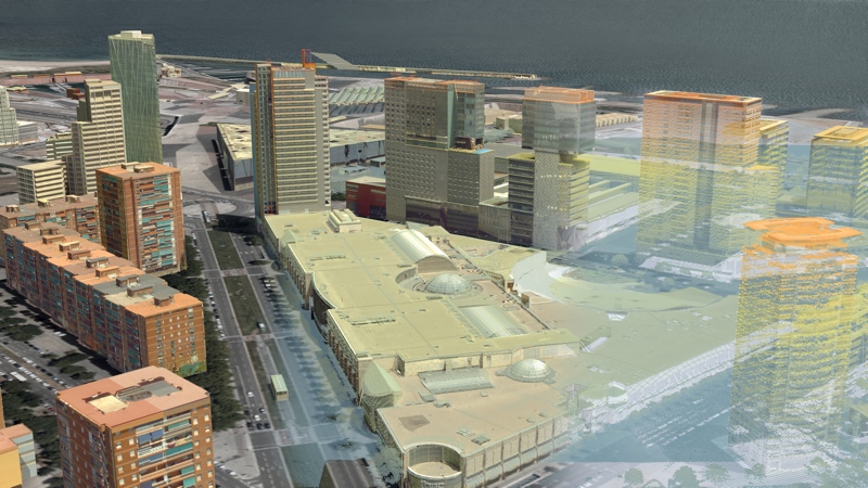
CityMapper has been specifically designed to perform urban mapping for smart city applications, where an accelerated rate of change requires that different data types be captured simultaneously. Anders Ekelund, vice-president for airborne LiDAR at Leica Geosystems says that “users can now save significant time and cost by flying once to collect twice the data as before.”
Smart Cities need Sensor Software Synergy
When you use the CityMapper data in conjunction with the HxMap software, Leica calls this the RealCity solution.
HxMap is a workflow application that processes data from multiple sensors—like those included in the CityMapper pod. When working with the expanded data set captured by the CityMapper pod, the HxMap user interface can generate a range of basic deliverables like orthophotos, point clouds, and 3D models “at the push of a button.”
Leica refers to this “comprehensive data output” as the “SmartBase,” a geospatial base layer designed to offer users the basic data needed to generate any kind of deliverable necessary. This includes the simple derivatives mentioned above, but also more complex products like digital surface and elevation models, and even “qualitative data on vegetation, street information, built-up areas and land use.”
The final benefit is the data needed “to stay current on city transformation and development to provide vital information needed for smart city applications.”


