
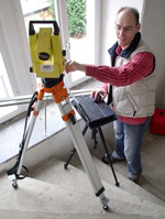
kubit recently released TachyCAD v7, which makes it possible to automatically and wirelessly transfer data from total stations (tachymeters), laser distance measurement equipment and GPS receivers into a standard CAD system. While surveying onsite, buildings, facilities, excavations or general topographies are surveyed precisely and displayed within CAD plans or as 3D models. Due to simultaneous measuring and drawing, missing or false measurements are noticed immediately. CAD documents are quickly generated, and measured objects are given attribute data onsite.
The company says that TachyCAD offers many functions that speed up the recording of typical components such as windows, doors, bow pieces, stairs or pipe. Database structures, which may be defined freely, grant the adaptation of attribute data, area data and feature data into CAFM systems and data bases, according to the company. Additional extensions are available for building survey, factory/plant survey and archaeological survey. Each provides functionality especially developed for the user’s specific needs.
New features of TachyCAD v7 include:
- The support of GPS receivers that allows data from GPS equipment to be used for the construction of any AutoCAD or TachyCAD geometry.
- The enhanced support of motorized total stations. By automatically aiming for control points, the process of stationing those points is sped up considerably. Another benefit is through TachyCAD0’s stakeout command. Selected points from the CAD drawing are automatically shown in the field by a motorized total station in order to determine, for example, the position of drillings or fixed points onsite.
- A measurement cache, which saves the measurement data transferred by the instruments. Users may refer to this data when, for example, a command has not been stated before a measurement or if users work in pairs. One person measures while the second person draws and can refer to the recorded values.
- An additional stationing procedure called the “Stationing without horizon.” This enables the combination of data taken from different positions on unstable surfaces such as surveying offshore.
- A new function that allows users to derive a plane from a cylinder, useful when surveying towers.
- A new command for the manual measurement of orthogonal rooms that optimizes the workflow for projects in which a hand-held laser will be frequently used. By using the arrow keys of the manual laser, TachyCAD receives information about the direction of the measurement and is then able to automatically draw the room. Remaining errors are equalized optionally, and separate layers are available to compare the true as-built to the best-fit CAD drawing.
- The Helmert transformation that allows users to fit components, planned in CAD, into the previously surveyed reality. This transformation may also be used to combine geometries that have originally been measured in different local coordinate systems.
- Tools for correcting incorrect plans, which show (on request) gaps, double lines and similar potential errors.
- Thoroughly revised area and feature management, including numerous new functions and ergonomic improvements and a significant increase in speed for very large data collections.
- Compatibility with AutoCAD 2010, AutoCAD LT 2010 and 64-bit operating systems.
A trial version of TachyCAD v7 is available to users upon request at www.kubitusa.com.


