


Among the most exciting parts of Geo Week every year is catching up with the diverse group of attendees, who come together from different industries and professionals all under the common umbrella of geospatial work. With that said, however, traditional surveyors remain part of the core audience for the event, and that is reflected in the conference program with sessions aimed at people who are involved in the industry.
At this year’s event in Denver, the session that was most relevant to this group of traditional surveyors – along with anyone whose work involves surveying in any form – was aptly titled Essential Surveying Practices. The session featured presentations from speakers who have long worked in the industry and who spoke to the importance of some of the most fundamental tools, like ground control points, as well as how things have changed in the space over time. The speakers for this session were:
Dr. Stewart Walker, LIDAR Magazine (Moderator)
James Gillis, VeriDaaS Corporation
Brian Shaw, NOAA National Geodetic Survey
Mohamed Mostafa, Trimble Applanix
Following an introduction to the 90-minute session from Dr. Walker, who noted that the presentations and panel discussion was taking place on the inaugural World Lidar Day, Gillis took to the podium for the first of three presentations in the Mile Hall Ballroom at the Colorado Convention Center.
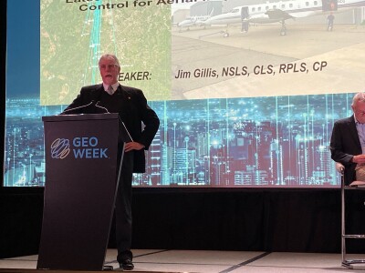
Gillis’ presentation was a wide-ranging one, drawing on his many years of experience in the industry and focusing on some of the most fundamental and important aspects of this work. After some discussion on the history of photogrammetry and topographic mapping, he talked about the importance of ground control points in these workflows and the crucial difference between precision and accuracy.
“I go way back to my college days when I was learning about surveying, and one professor explained it this way,” Gillis relayed to the crowd. “Precision means refinement of measurement. If you’ve got a ruler and measure to the nearest foot, that’s not as precise as if you measure to the nearest inch. Accuracy, on the other hand, means nearness to truth. There is true value for the position, and the closer you are to the true value, the more accurate they are. Accuracy and precision are totally different things.”
Along with his talk about the importance of this accuracy, and in turn why it’s so important for redundancy in work and consistent quality checks, Gillis also outlined the major types of survey methodology along with some of the pros and cons of each. On that area, he talked about GNSS for static and RTK, GNSS for real-time networks, GNSS from real-time precise point positioning, conventional surveying techniques, and the newer terrestrial scanning and mobile mapping tools. Above all, though, Gillis highlighted the importance of experience and continuing to build that experience to figure out important questions about ground control necessity, the number of points needed, and how accurate each individual project needs to be.
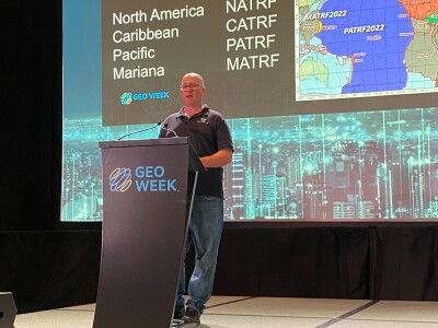
Following Gillis was a presentation from Shaw, who relayed that this is part of his job with NGS. Shaw serves as the Rocky Mountain Regional Advisor, meaning he speaks with people within his region to help understanding around dataums, plane coordinate systems, and just good surveying practices. In this presentation, he had a lot to cover with the NGS modernizing the national spatial reference system. After providing resources for attendees to find more information around these topics, Shaw spoke about why these systems need modernizing.
He talked about the infinite complexity of Earth’s shape, and the ways our understanding of it has evolved. Shaw also acknowledged how hard it can be to wrap one’s head around the idea of datums and reference surfaces, and relayed how he used children’s growth charts to get the idea to click. He talked about how he used to have his height progressively measured on a wall at home as a child, and how, when his parents replaced the carpet with hardwood, the reference point for these heights changed. “It didn’t make much difference because I wasn’t surveying anything, but in essence that changing of that reference surface is what we’re doing when we’re modernizing the national spatial reference system,” Shaw said.
Our current models that are used as reference points are based on old technology, meaning that points can have changed significantly. Shaw talked about how tectonic plates have shifted so much of this, with the NGA breaking things up into four plates that each need their own reference frame. In the Pacific, for example, Hawaii is “drifting” horizontally by 7.3 centimeters for years. It’s these transformations that are being targeted by this modernization process.
Finally, Mostafa built upon the fundamentals which had been the focus of the previous two presentations and talked about how those are being applied to modern workflows, largely with UAV mapping. He showed off a few different projects to exemplify this, including work from NOAA in post-disaster areas and the mapping of a German automotive corridor. Even talking about how far we’ve come in this space of aerial mapping, all the way up to modern systems which seamlessly integrate lidar and photogrammetry, Mostafa made clear the importance of ground control points to guarantee accuracy of your work.
Following the three presentations, there was time left over for questions from both Dr. Walker and members of the audience, where the three speakers were able to delve further into topics of importance to surveyors. Mostafa, for example, spoke about the need for stronger universal standards, saying to this point we’ve simply “scratched the surface.” Shaw also spoke more to the importance of map projects, and Gillis gave advice to young surveyors, saying starting with convention methods (i.e. total stations, etc.) will provide a strong base to make it simpler to transition to newer methodologies.


