
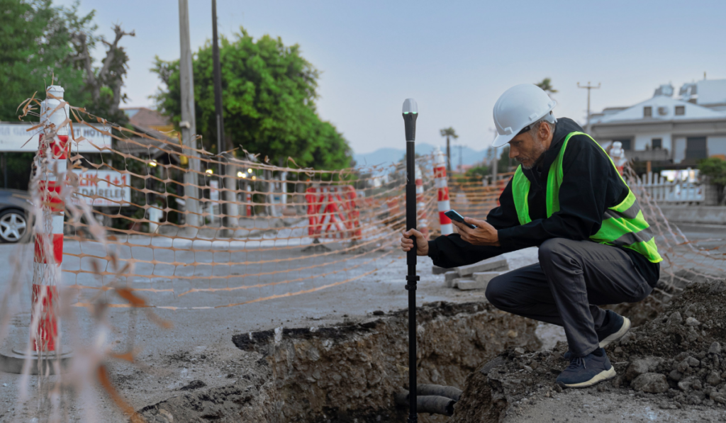
Emlid’s Reach RX network rover is a high-performance multi-band RTK rover that tracks GPS/QZSS, Galileo, Glonass, and Beidou and is designed for working with any corrections network (NTRIP) to provide centimeter-accurate positioning. Emlid Reach RX has compact design and weighs just 250 grams, so it can be carried in a backpack pocket or attached to clothing. Reach RX features IP68 ingress protection and operates at temperatures ranging from -20 to +65 °C (-4 to 149 °F). The Reach RX battery lasts 16 hours on one charge. The receiver charges from a power bank, USB wall charger, or a computer USB port over Type-C.
Reach RX is designed to meet the expectations of both experienced professionals and non-surveyors who need to get highly accurate results. Among various Reach RX applications are construction and building inspection, for site planning and progress monitoring, boundary or land parcel measurements as well as drone mapping (placing ground control points), utility inspections, monitoring, and mapping of urban infrastructure, precise farming (laying out the land parcels, planning of beds) and environmental monitoring in urban areas.
Reach RX is a network RTK rover, providing real-time centimeter-precise positioning when it receives GNSS corrections. They can be obtained from any corrections network over NTRIP, the most commonly used protocol to stream GNSS corrections. For example, with a subscription to an NTRIP service, users can connect Reach RX to the nearest corrections network. Another option is creating one’s own network using Reach RS2 or RS2+ receiver as a base station (in other words, as a source of corrections) and free Emlid Caster as a way to send the corrections to Reach RX. To use Emlid Caster, all that is required is signing up and get the required credentials for a base and rover (or multiple rovers).
Surveying with the ReachView 3 app
Reach RX comes with the ReachView 3 app for iOS and Android. This is a free and user-friendly app that allows users to connect Reach RX to the corrections network, collect and stake out points on site, import, and export collected data for further use in CAD, GIS, or drone mapping software. To get started, Bluetooth needs to be enabled on a device, after which Reach RX in the ReachView 3 app needs to be found, and credentials of a corrections network need to be entered. No more configuration is required.
Providing the highest possible accuracies
When talking about GNSS RTK equipment in general, usually the centimeter level of accuracy is implied. To achieve the best possible results, Emlid recommends considering two main factors that influence survey accuracy. The first one is a baseline or a distance between the base and Reach RX rover. Simply put, the shorter the baseline, the better. That’s the reason why some users prefer to survey with their own Reach RS2 or RS2+ base station, rather than using public correction networks with the remote base stations.
The second crucial factor is the surrounding conditions on a survey site. The rover should have a clear sky view 30 degrees above the horizon. If highly accurate results are required, there should be no obstacles that could block the view like buildings, trees, cars, humans, etcetera. It’s also recommended to keep all electronics as far as possible from the rover since electronic devices could affect the reception of the GNSS signals.


