Emesent, a global leader in autonomous digital mapping, has further enhanced the utility of 3D LiDAR data captured by its award-winning Hovermap scanner with the release of a Handheld 360 Image Kit and an update to its Aura data processing software.
Emesent will showcase how the Handheld 360 Image Kit adds additional contextual information to Hovermap point clouds with 360-degree panoramic imagery during the upcoming Geo Week exhibition at the Colorado Convention Center, Denver, 11-13 February.
“Our customers love the quality of the data they get from Hovermap, and we’re now providing additional context to augment the LiDAR data and allow them to derive new insights. The panoramic images are very useful for scan-to-BIM workflows and generating virtual tours.” said Emesent co-founder and Chief Strategy Officer Dr Stefan Hrabar.
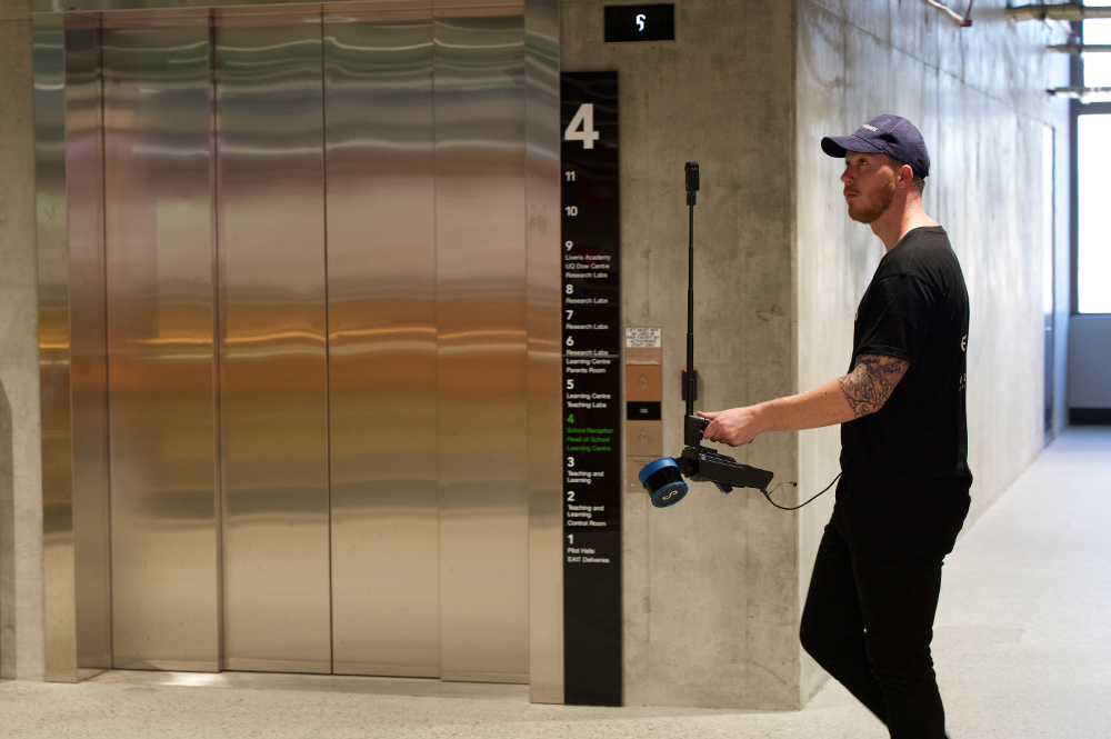
The 360-degree camera attaches directly to the Hovermap unit and is designed for operators to comfortably hold in one hand, enabling easy capture of panoramic images and 3D LiDAR data at the same time.
The telescoping mount elevates the 360-degree camera to minimize occlusions. Meanwhile, the operator is masked from the images to maintain privacy. Operators can also use their own custom camera mounts to suit their applications.
A streamlined workflow in Emesent’s Aura data processing software automatically registers the images to the point cloud without the need for calibration. Once registered, Aura supports exporting the images and LiDAR data for display in third-party platforms including Pointerra3D, Cintoo Cloud and Bentley iTwin.
Together with the new Handheld 360 Image Kit, these platforms support a broad range of construction, engineering and architecture scanning scenarios, including:
- Site documentation and progress tracking.
- Safety inspections to identify potential hazards and confirm compliance.
- Quality control through inspection of construction materials, structures, and installations.
- Identification of defects or inconsistencies that might be missed with conventional photos or inspections.
- Design and planning via immersive panoramic 360-degree images for architects, engineers – and their clients – to visualize a project and make design decisions.
- Stakeholder communication.
- Virtual tours and marketing.
- As-Built documentation.
- Training and education.
Emesent will demonstrate the scan-to-display workflow for point clouds enhanced with panoramic imagery at the Geo Week exhibition, booth #735, Colorado Convention Center, 11-13 February.
To learn more about Hovermap, Aura, and the Handheld 360 Image Kit visit Emesent’s website.
Demonstrations of Hovermap, the Handheld 360 Image Kit and Aura are available, simply book a demo.
Source: Emesent