SPAR to kick off with primers, continuing ed from ASCE
HOUSTON—Though the keynote presentations for SPAR International won’t kick off until Tuesday, March 22, the Woodlands Marriott here will be buzzing with 3D imaging talk well before that. Monday, March 21, will feature important primers and continuing education opportunities that are hard to find elsewhere.
First, the American Society of Civil Engineers offer a day-long program, worth 8 PDUs, that will focus on real-time GNSS positioning and using the 3D Global Spatial Data Model.
“These are technologies that are sweeping the nation,” said Brian Sien at the ASCE. “The two speakers that are presenting at the workshop are well known and very qualified.”
Bill Henning, senior geodesist for the National Geodetic Survey, leads the morning session. With more than 43 years of experience in all phases of surveying technology, he is currently helping to develop guidelines and support methodology for real time GNSS position with state, national, and international organizations. Not many people know more about this stuff than he does.
Earl Burkholder, professor emeritus with New Mexico State University, will lead the afternoon session. He has dedicated himself to educating the surveying community on the benefits of using the Global Spatial Data Model, including publishing a book on the topic, and he is the recipient of the ASCE’s 2010 Surveying & Mapping Award.
There is an additional fee for attending the ASCE’s continuing education event.
Also on Monday, SPAR International will offer two “primers,” what were known as “boot camps” in previous years, on mobile scanning and using 3D imaging for civil infrastructure and industrial plant applications. These are excellent two-hour immersive experiences that will allow anyone relatively new to 3D imaging to more fully enjoy and understand the rest of the conference programming.
Leading the mobile mapping programming will be Ray Mandli, head of Mandli Communications. Mandli is one of the earliest adopters of the mobile scanning platform and is an evangelist for the technology. “We can take sensors from just about any discipline and integrate them into a mobile platform,” Mandlii said. He has an H2 that he uses for capturing data along rugged terrain, and once used a Mini Cooper, which he has now retired and operates as his personal vehicle.
Mandli has extracted some one million assets from mobile scans conducted for all manner of organizations, from DOTs to gaming programmers. He’ll be joined by Clay Wygant, of WH Pacific, and Craig Glennie, from the University of Houston. Together they’ll examine the safety and business benefits of mobile scanning, look at the options for software and hardware packages, and give attendees tools for both commissioning these services or beginning to offer them themselves.
Chris Zmijewski, principal at Stantec, will, along with Tim Rennie, EVP of Engineering and Construction at ENGlobal Systems Inc., lead the industrial plant primer programming.
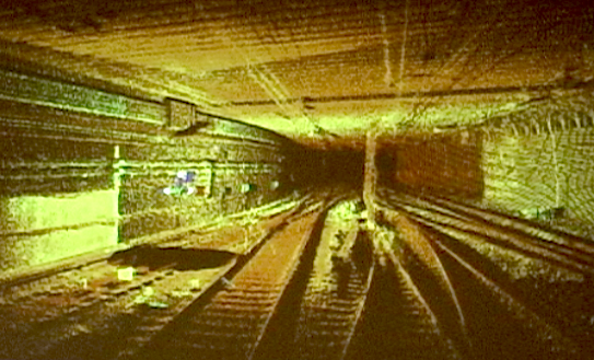
As the practice leader for 3D digital imaging and mapping at Stantec, Zmijewski is responsible for all initiatives involving 3D scanning for the company. Speaking about the great utility of laser scan data, he noted a project his firm had done with Penn Station: “For the first time our office, in Manhattan, had the ability to look at Penn Station from the track level all the way through to the top of the building in one cohesive 3D model,” he said. “The beauty of using laser scan data, when we think about point cloud data, and 3D, is that we can have all of the upper part of Manhattan, the buildings above, the track level of Penn station below, and the subway levels below that all together.”
On the civil infrastructure side, Jody Lounsbury, section manager, 3D Laser Scanning, for CHA; Tim Case, director of asset management at Wright-Pierce, and chair of the 3D Information Management Working Group at the Open Geospatial Consortium; and Martin Dunn, VP at METCO Services will address issues specific to surveyors in projects that involve buildings, civil structures, roads, bridges, tunnels and other transportation applications.
Attendees here will learn about typical workflows, how to integrate scan data into the enterprise as a whole, and how to supervise and specify scanning projects.
These primers are offered at no additional cost for SPAR International attendees.
SPAR International will be held from March 21-24, at the Woodlands Marriott in Houston, Texas. For more information, visit www.sparconference.com.


