In the past, Esri’s CityEngine was mostly used as a 2D to 3D modeling tool, but its latest release demonstrates its potential for becoming a specialized tool for urban design and as a 3D data import/export tool to enable new immersive computing experiences.
Using CityEngine for VR/AR workflows
CityEngine is Esri’s 3D desktop modeling software for detailed large-scale 3D city models. It is used for urban design, site planning, master planning, as well as a tool for delivering VR/AR experiences to planning and GIS professionals. CityEngine is also an import/export tool for GIS data. With regards to AR/VR, CityEngine can export GIS and 3D data to three different media: First, to ArcGIS 360, a mobile VR app for light-weight mobile devices that enables users to look at urban planning designs, for example showing multiple examples of a proposed building. ArcGIS 360 is an Esri lab project that is currently “in maintenance” mode.
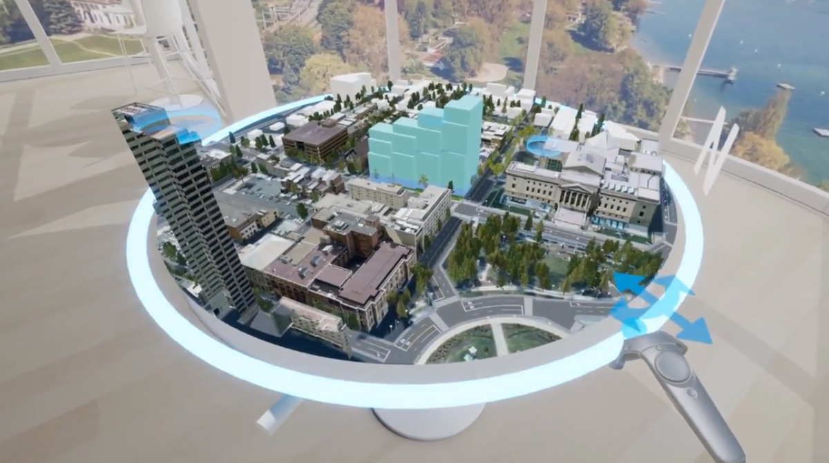
Second, there’s CityEngine VR Experience, a premium VR app for HTC Vive and Oculus Rift wearables offering a “tabletop” user experience, where users can interact with city development scenarios on a real or virtual table. Not only is this a common user experience pattern in AR/VR deployment nowadays, it also takes away the problem of motion sickness that comes with many of such applications. The CityEngine VR Experience was released at the end of 2018; the latest CityEngine release adds support for Oculus Rift headsets.
Third, CityEngine functions as a gateway to the Unity and Unreal gaming engines for developing extended reality apps. While there are more gaming engines on the market than these two, Unity and Unreal together have the largest market share, which is why Esri mainly focuses on these two. Esri uses the term extended reality (XR), which brings together AR, VR and MR, and refers to an immersive computing environment. While Premium VR is a more expansive form of VR than Mobile VR and offers better graphics, the two are converging quickly.
Gaming engines are interesting for GIS workflows, as they can be used for real-time rendering of 3D GIS data as well as delivering interactive experiences from AR/VR apps. Currently, there are still limitations on using gaming engines with GIS and web-GIS: gaming engines don’t have geo-referencing which means they cannot handle coordinate systems. Also, streaming GIS data at runtime does not really work yet, bringing in terrain data into gaming engines is challenging and the geographical scale of a scene is still limited. Esri is working with both gaming engine providers to overcome these issues and make a streaming of GIS data at runtime an eventual goal.

CityEngine integration with ArcGIS Urban
Additionally, the latest release of CityEngine shows that it is becoming a more specialized tool for urban design. CityEngine 2019.0, released in May, now offers integration with ArcGIS Urban, a soon-to-be-released web-based urban planning platform that runs on top of Esri’s JavaScript API. ArcGIS Urban can be used for visualizing master plans, monitoring development projects across the city, management zoning codes and overlays and engaging with citizens.
The difference between the two applications is that CityEngine is a desktop application, whereas ArcGIS Urban is a web-based application. For the future, ArcGIS Urban will definitely be the preferred option as field workers wearing AR/VR devices will have access to remote GIS data through an internet connection. Additionally, CityEngine provides detailed modeling capabilities that ArcGIS Urban doesn’t offer: this is also one reason for the integration between the two applications.
With the 2019.0 release, the integration between the two different applications enables data sharing between the two environments. In the future it will be possible to access ArcGIS Urban data directly from an AR/VR wearable, instead of relying on data exports from CityEngine (as is the case now). High on the list is support for the Microsoft HoloLens2 wearable, that has seen a great uptake in the geospatial industry since its release. This also will turn the CityEngine VR Experience into an XR experience.


