
ChronoCards is a remote collaboration tool that enables improved GIS workflow management through activity logs, workflow documentation, and reporting tools for ArcGIS Pro. Just like Github, it logs the work of GIS analysts in code in real time, showing everyone’s activity more or less when it happens.
ChronoCards was created by Mike Davlantes, who started as a cartographer and GIS analyst. Over the years, he became a self-taught software engineer to automate GIS workflows and work more efficiently. His company ChronoCards was a result of geospatial freelancing and consulting work around 2016. The tool started from a need for a similar tool for GIS that potentially could save analysts a lot of time and effort, as no GIS tool logs exactly what anyone is doing with the software or that is easily searchable months later for other team members.
Enabling onsite and offsite GIS collaboration
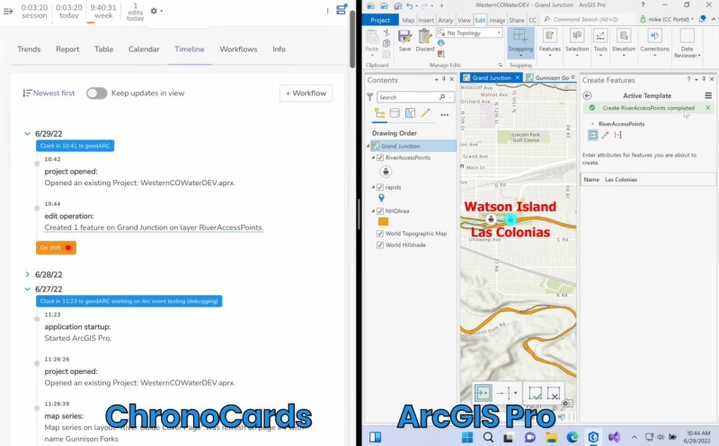
Chronocards is available as an add-in for ArcGIS Pro, that connects to a cloud-based or on-premise software application. The add-in logs metadata about a team’s activity in ArcGIS Pro and streams it in real time to a web dashboard. Add-ins enable custom functionality to the software and can be added manually with the ArcGIS Pro SDK 3.1. The ChronoCards add-in enables adding updates to the project without losing time recreating undocumented workflows, as ChronoCards pulls up the exact steps that were followed in the project with comments to understand down to the individual parameter what individual team members did to be able to improve GIS analysis.
The add-in intends to retain the universal knowledge when one analyst goes from one job to another because it is difficult to recreate a geospatial analysis if nothing has been written down. ArcGIS Pro itself offers limited out-of-the-box functionality to pull out pieces of an analysis workflow through the Geoprocessing History tab, provided that an ArcGIS Pro project file of the analysis was saved. However, this functionality does not tell you why this analysis happened, who did it and there’s no option to leave comments for others. “This results in having to open up multiple ArcGIS Pro Project files, find the one you’re looking for and scroll through thousands of operations and hoping it can be used to reproduce the analysis”, says Davlantes.
How ChronoCards logs GIS analysis in a meaningful way
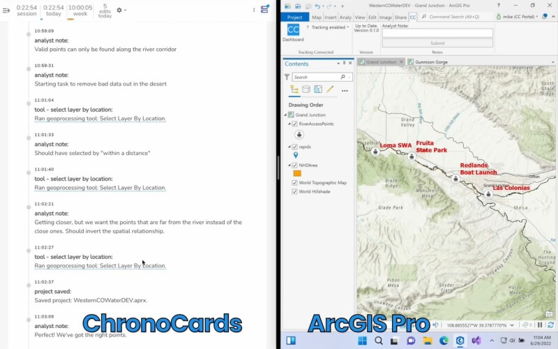
The ChronoCards add-in provides context to an ArcGIS Pro Project file, when the analysis was done, and by who. It enables the user to filter all these things to pick out the relevant pieces of information. This makes it easier to make sense of thousands of geoprocessing history operations and get the information that is needed. ChronoCards provides the history associated with Project files even without the files themselves, saving all edits, geoprocessing history, and names of the associated layer files.
That information is either saved in the cloud version of ChronoCards or on-premise. The cloud version requires the user to only install an add-in for ArcGIS Pro with the ChronoCards software running in the cloud. The on-premise version has the benefit that it can offer more granular data, as the data is already available on a server and ChronoCards does not have to maintain multiple sets of client data.
Recreate and share “best practice” GIS workflows
ChronoCards also lets users create new workflows from a log and group them into an IPython or Jupyter notebook that can be brought into ArcGIS Pro and run as a script, and shared with others. This not only allows GIS analysts to document the work as they go but also recreate a “best practice” workflow by selecting the best pieces of a normal workflow that would include lots of trial and error. The ChronoCards web app offers a reporting dashboard that enables users to slice and dice logs in multiple ways to be able to see individual and team progress over time.
Davlantes explains the need for an application such as ChronoCards as follows: “Although it might look like an ideal solution for remote teams in the first place, the need for a solution as ours existed before remote work happened. It was just highlighted by remote work. One of the big inflection points for ChronoCards was when Apple sent their mapping team home during the pandemic, they signed up for ChronoCards to be able to see teams working together. But, you don’t have to be remote to see the benefits of the solution, it’s also great for people collaborating in the office. Besides, it provides useful numbers and metrics to GIS managers. Similar to GitHub, we’re working on branching your data to be able to do a lot of editing across different environments and check branches out of the data, apply all the edits to a stack, or pick and choose which changes get merged in. Finally, we want to integrate data edits and analysis that happen in the browser, such as ArcGIS Online or web maps”, concludes Davlantes.
Source: ChronoCards – Building a Business on ArcGIS Pro, Mapscaping podcast


