While older industries like construction, which has been around in some form since ancient times, are typically looked at as reluctant to embrace technology, that’s not entirely true for surveying. In recent years, technology around this space has exploded, with drones becoming a nearly ubiquitous tool in many circles in the industry by this point. Surveyors were among the first to really embrace the commercial UAV market, and the benefits here are wide-ranging. Utilizing drones allows surveyors to complete projects much more safely and quickly, and in some cases open up a new range of projects that otherwise wouldn’t have been possible.
At the same time, while it may be overstated there is still some reluctance to fully embracing what new technology has to offer, or at least some barriers that make it more difficult than it needs to be. One of the most significant of those barriers is simply the number of tools available, and the number of different tools often needed to complete an entire project. There are great individual programs, but the need to mix and match in the right way can be an unnecessarily complex process. Due to that, we have seen a number of companies in the space partner to provide end-to-end solutions for surveyors, and we recently got an announcement for another one. Software company Carlson Software announced last month that they’d be partnering with UAV manufacturer Autel Robotics to provide what they describe as a full UAS to CAD workflow.
Under this new partnership, users of Autel Robotics’ EVO II Pro Series drone will also have access to the full suite of Carson’s software and hardware solutions to pair with the drone. This is a big deal, as it can be time-consuming and costly to find solutions that integrate well together, and this removes the risk of investing in a group of solutions that may not end up working together seamlessly. Although surveyors are certainly becoming more and more technologically savvy, it’s still not quite within the job description to easily determine which solutions will work well together. These types of partnerships take that responsibility off the backs of professionals, allowing them more time and headspace to concentrate on the work for which they’re trained.
Founded in 1983, Carlson Software is a well-established software company which specializes in CAD design, field data collection, and machine control products for surveying, AEC, and mining industries around the world. Users of the EVO II Pro Series will have access to the company’s suite of tools, which includes, but is not limited to, the following:
- Carlson PhotoCapture, which takes a user’s flyover data captured with a drone and quickly generating interactive 3D maps, which can then be shared easily with customers.
- Carlson Point Cloud, which delivers “powerful automation for large data sets.”
- The full suite of Carlson’s CAD software, including an option designed specifically for surveyors.
- The Carlson BRx7 GNSS receiver, which can be used as a rover or as a base to send corrections to RTK UAVs or GNSS rovers.
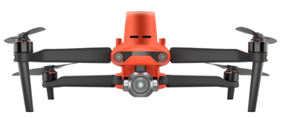
Autel Robotics is a Washington State-based company founded in 2015 which specializes in the design and manufacture of drone, aerial photography devices, quadcopters, and flying camera systems. The Evo II Pro Series is the company’s first 6K folding zone and can be used for high-quality aerial imagery. Using Sony’s SMOS sensor, the drone provides low-light photography video resolutions up to 6K, as well as improved dynamic range and noise reduction in comparison to previous models. The device is also equipped with 19 groups of sensors, allowing it to easily build 3D maps and plan paths through complex terrains in real time, and also provides the ability for 360-degree obstacle avoidance.
These kinds of partnerships are invaluable for surveyors and those in industries like AEC and mining, taking away a time-consuming, and frankly overly complicated, process of trying to mix and match different solutions to achieve a desired outcome. Derek Roché, Carlson Software Regional Manager, said of this pairing, “We can take you through the entire project lifecycle from setting your ground control points with a BRx7 GNSS receiver and RT4 data collector with SurvPC field software to the actual drone flight to the photo processing on your computer or in the cloud, all the way through to processing that data, creating linework, surfaces, and finished plans in CAD with our powerful, industry-standard office software.”