

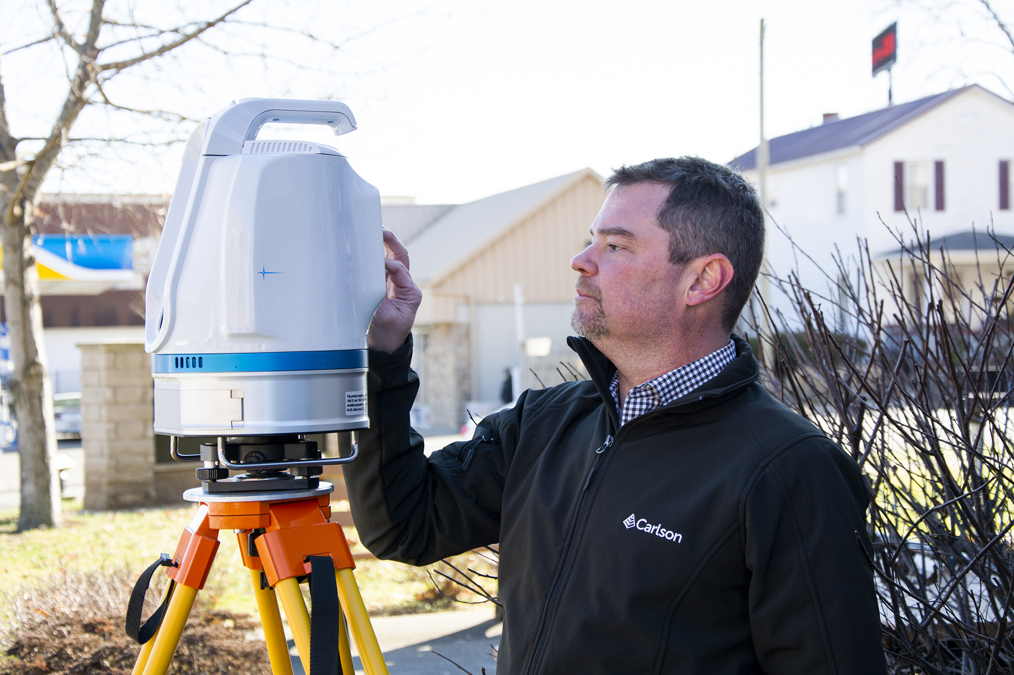
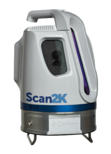
The Carlson Scan2K is Carlson’s latest lidar solution for the creation of accurate 3D point clouds with ranges up to 2,000 meters under the right conditions. The Scan2K was designed with a total station workflow in mind simplifying the field data collection and georeferencing procedures. The Scan2K was designed with the surveying and mining environment in mind and is at home in the field with its weather-proof IP64 housing, sunlight-visible touch screen interface with intuitive menu-driven operations for quickly collecting and georeferencing point cloud data. The Scan2K features an integrated high-resolution camera, inclinometers, a compass, and an L1 GNSS receiver. The Scan2K can be deployed in various environments and orientations, including mobile and kinematic operations.
Combining a long range with a variable Vertical Field of View
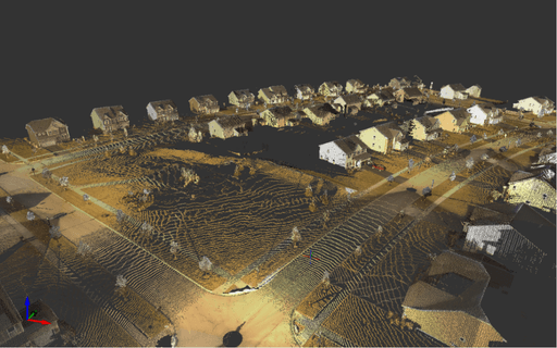
The Scan2K’s long-range capability places it among the longer-range capable scanners in the market. By taking advantage of the unit’s long-range capability, the user can optimize scanner setups to minimize time in the field. By combining the long-range capabilities of the Scan2K along with its ability to adjust the variable Vertical Field of View, the user can focus detailed scans of areas of interest, thus saving time and increasing the data density where needed.
 The Scan2K offers the user a wide range of features that make it a serious contender in the static lidar market. First and foremost, the Scan2K enables the user to operate in three scanning modes depending on the type ranges they are working at. Each of these scanning modes offers a different associated scan rate: a short-range mode (up to 250m) with 500 KHz points per second; a medium-range mode (up to 750m) with 200 KHz points per second; and a long-range mode (up to 2000m) with 50 KHz points per second. In addition to the variable range modes, the Scan2K also records four returns per pulse, which enables conducting “bare earth” filtering to help remove vegetation from scans among other things, such as dust penetration and such.
Another unique aspect of Scan2K is the ability to have a variable vertical field of view. The scanner’s maximum vertical field of view is 120° and the system will pulse at the range mode selected over that vertical field of view. When the Vertical Field of View is narrowed, the scanner will in turn pulse over that narrowed vertical field of view and thus collect more data in that smaller area. It is not masked like in other scanners that don’t have this capability.
The Scan2K is perfectly suited to tackle the mining industry. The long-range, 2000m, capability couple with the adjustable vertical field of view allows the Scan2K to conduct high-wall scans, high-wall monitoring, general pit scanning and volumetric. With the ability to switch to short-range modes, the Scan2K can work great in underground applications as well.
Software and GNSS receiver
The solution comes with the basic ATLAScan Works that enables controlling, georeferencing, registering point clouds from various setups and prepare the point cloud to be passed onto Carlson Point Cloud Software. This is a CAD-based program for working with point clouds of up to 1 billion points and create products such as contours, profiles, sections, and brake lines, all while seamlessly integrating with Carlson’s Survey, Civil, and Mining solutions.
The laser scanner comes standard with a built-in L1 GNSS receiver and compass for coarse positioning and orientation, that is used to help the point cloud registration along if there is no other control available for the scans. Additionally, the solution comes with a couple of optional hardware features such as the ability to use an external high-end DSLR Camera for more detailed imagery work, external GNSS Antenna mount and the ability to be used in mobile lidar functions in both land and marine applications.
The key to being versatile
The Carlson Scan2K positions itself very well in the market in terms of versatility and speed. In terms of versatility, the Scan2K can be used and mounted in a variety of ways and conditions: from permanent outdoor monitoring installations, tripod deployed scans and mobile mounted deployment, the Scan2K operates seamlessly from operation to operation.
The key to being versatile is the software and user workflow: having a simple and dynamic workflow on how to collect and process the data is key to standing out in the market.
With respect to speed, the Scan2K embraces a Total Station type of workflow in the field and that allows field operations to be done quicker and with minimal training. By utilizing the onboard georeferencing capabilities, the users can quickly establish control and orientation in the field in a simple to follow manner. By utilizing the adjustable Vertical Field of View, the user can focus the scan in a much narrower area and thus saving even more field time.


.jpg.small.400x400.jpg)