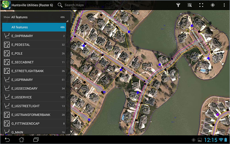
New Map Mobile Android app lets field techs respond to asset emergencies more quickly
3D infrastructure design software firm Bentley Systems, Inc. on Wednesday rolled out two new mobile apps for infrastructure and construction field workers.
The Bentley Map Mobile free app for Android devices lets infrastructure professionals share with field technicians geospatial information from Bentley Map, the company’s desktop geographic information system (GIS), about the landbase; utility, telecommunications, and transportation networks; and other spatially managed infrastructure they support.
Map Mobile also helps field workers respond to emergencies and maintenance issues more quickly, reducing disruptions and increasing uptime for utilities and other infrastructure assets.
Map Mobile, soon available for iPad and Windows 8, requires the use of Bentley Map Mobile Publisher to publish i-models, which package 3D models with drawings and PDFs aggregated across data sources such as Bentley’s Map Enterprise, Utilities Designer, and other products, including Bentley Coax, Bentley Copper, Bentley Fiber, and Bentley Inside Plant.
Bentley’s Field Supervisor app for the iPad gives construction workers in the field online and offline access to secure and current information managed by Bentley’s ProjectWise suite of engineering project collaboration software, and eB, the foundation of Bentley’s AssetWise system of servers and services to manage information and change throughout an asset’s lifecycle.
The app also lets field workers create personalized views that group and filter information stored in multiple project data sources based on its relevance to their specific project roles and tasks, whether engineering documents or Microsoft Office documents.
“Supervisors, foremen, inspectors, and other field construction professionals are tired of wasting countless hours searching through sometimes hundreds of printed documents to find the handful that are relevant to their project tasks,” said Harry Vitelli, Bentley vice president, construction and field. “And, once they locate the ones they’re looking for, they’re never sure the information is up to date, which is of particular concern when the decisions being made impact safety compliance and/or risk management.”


