When you think of infrastructure work, you probably picture above-ground construction. But it’s just as important to consider what’s happening below ground—the realm of the geotechnical engineer, who “utilizes the discipline of rock and soil mechanics to investigate subsurface conditions,” to determine the effects of water, tides, and other physical conditions on the building project.
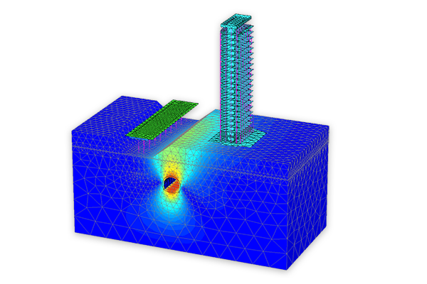
Bentley Systems, ever concerned with advancing infrastructure by helping projects convert to a digital workflow recently announced the acquisition of of two geotechnical solutions providers. Bentley explains that, alongside its existing geotechnical offerings, these new acquisitions will help make BIM advancements available during the subsurface engineering steps of every infrastructure project.
The first, Plaxis, is a Netherlands-based provider of geotechnical software, and the other, SoilVision, is a Canada-based provider of soil engineering software.
Plaxis and SoilVision software will be fully integrated with Bentley’s structural applications, meaning that users will also be able to make use of Bentley’s ContextCapture reality modeling solution for continuous survey of the site.
“For today’s infrastructure demands, geotechnical considerations are coming to the fore,” Bentley explained in an official statement.
“Because infrastructure assets are crucially linked to subsurface environs, they are vulnerable to geo-environmental risks including seismic activity, subsidence, and weather impacts. Leveraging new digital workflows which incorporate real-time monitoring and analytics during infrastructure operations, geotechnical professionals can play the increasingly valuable role they deserve in achieving geo-environmental resilience.”
For more information, contact Bentley Systems.