
3DR has announced new features for Site Scan, the company’s automated 3D-mapping solution for drones. The Site Scan Manager app and Site Scan Field app have been updated to include support for ground control points, enabling users to georeference their 3D maps.
Using the new functionality, construction users input survey control points in a number of different coordinate systems. Locking the files to a static reference point will increase the accuracy of orthomosaics generated by Site Scan. The company says accuracy should be improved, from a couple of feet down to “an inch or two.” This will allow you to perform new tasks such as “check[ing]the placement of forms before pouring concrete, trenchwork before laying pipe, and beams before fastening down.”
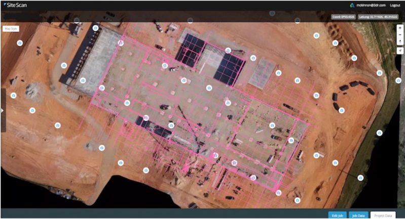
Site Scan also enables users to compare CAD engineering files to as-built documentation. Construction users can fly a site regularly, then compare the geo-referenced as-built scans to the original design. This workflow identifies errors and deviations before they cause expensive and time-consuming rework.
3DR’s process is not totally automated, though. Users who upload engineering files without georeferencing data will be prompted to send the file to a “Success Services engineer” at 3DR for translation into the right coordinate system.
Site Scan’s other new features are a new project interface for progress monitoring, and a battery failsafe feature that returns a drone to start when the charge is close to depletion.


