The USGS 3D elevation program—an initiative to gather nationwide lidar data by 2023—has been a source of considerable excitement within the geospatial community in recent years. However, we all know that data is useless if it’s not easy to access and manipulate. A new dynamic map service should help with that.
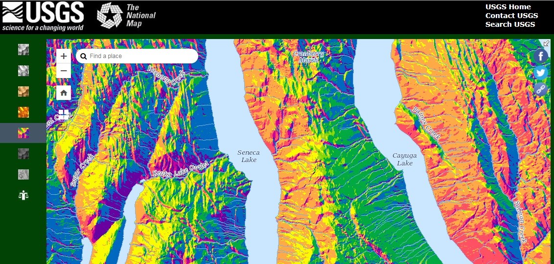
This new elevation map service introduced by USGS last week enables users to create multi-resolution visualizations on demand, offering quick access to a number of representation types, including automated contours, hillshade, aspect, slope, and tinted hillshade. Users can generate DEMs at a mixture of scales, down to 1 meter.
USGS has also created interfaces for interoperability with Open Geospatial Consortium (OGC), Web Map Service (WMS), and Web Coverage Service (WCS).
Not all scales and resolutions are available for all locations, USGS warns. However, the most current and highest resolution data is highlighted for easy reference, and datasets are all described on the 3DEP Products and Services webpage.
This is just a taste of the full feature set, which also includes functionality for mashing lidar data with other National Map data layer and working with services in the National Map Viewer.
Test it out through the 3DEP Demonstration Elevation Application, or read the USGS’ press release here for more information.