Visual Technology Services ramps up earth science support
Visual Technology Services Ltd. (VTS) on Monday released new features in its 3D PDF generation and conversion software that target location-based industry professionals with geospatial modeling, analysis and communication.
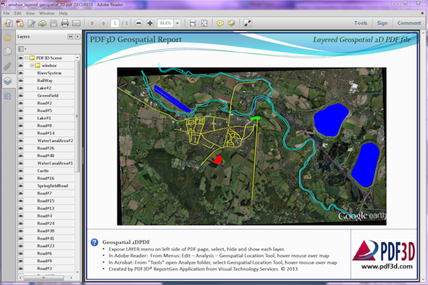
The British firm said its 3DPDF publishing technology allows users to convert multiple formats of data into 2D and 3D interactive PDF documents that can be viewed, shared and accessed by anyone with the free Adobe Reader, without plugins and multi-vendor installations.
The new v2.8PDF3D includes updates to PDF3D ReportGen and the core PDF3D SDK (software developer’s toolkit) for enhanced geospatial 2D and 3D report generation.
“Acquisition, processing and modeling technology is increasing data size and complexity at an incredible rate within GeoINT [geospatial intelligence], oil and gas, marine, mining and civil engineering environments,” said Ian Curington of VTS. “It’s an exciting time for geospatial professionals, but as a result, it has become increasingly difficult to communicate geospatially accurate reports to others who can’t access the primary geospatial modeling software platforms.”
The software also covers applications in the geology, aerospace, architecture, product packaging, and online sales and marketing industries.
“We’ve been working closely with some of the largest geographic systems organizations in the world over the past two years to develop a solution that doesn’t add to an engineer’s workflow but instead simplifies it,” Curington said.