
AeroMetric supplement helicopter aerial photography with digital imagery, lidar or video
Aero-Metric, Inc. has introduced a new High Accuracy Mapping system to capture low altitude details for engineering design and detailed applications in transportation corridors, transmission lines, and pipeline routes.
Sheboygan, Wis.-based AeroMetric is a geospatial services firm offering enterprise GIS, on-premise and in the cloud, and professional mapping services including photogrammetric, lidar, satellite, and airborne imaging technology.
The company’s High Accuracy Mapping sensor systems are based on digital image and lidar acquisition at very low altitudes – typically 500-1,000 feet above corridors.
The platform employs four sensors to collect data simultaneously, resulting in precise orthophotography and other lidar-derived deliverables.
“The new sensor system’s drift control allows it to remain aligned with the corridor regardless of the direction the aircraft is flying to adjust for wind conditions,” said Terry Keating, AeroMetric chief technology officer. “This is an important feature that will provide our clients the accuracy and detail they will require for engineering level mapping.”
The sensor system includes a RIEGL VQ-480i lidar sensor, a Phase One iXA 80 MP digital camera, and is controlled through Track’Air’s Flight Management System.
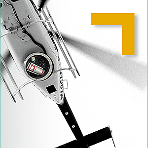
The new system is designed to obtain tight vertical accuracy and highly detailed imagery using a helicopter-based sensor system mounted on a drift-control platform.
Through the use of the eagle eye mapping system, AeroMetric can supplement its helicopter aerial photography with digital imagery, lidar or video, to add value to projects.
Final deliverables can include digital orthophotography, allowing the entire corridor to be visualized in detail, as well as topographic maps and planimetric maps of proposed vertical and horizontal alignments and final routes.
AeroMetric can also provide deliverables in PLS-CADD format for transmission lines.
The High Accuracy Mapping platform is also be used as a mapping tool showing closely spaced contours and planimetric detail. Applications include engineering design, mining operations, stockpile volumes and emergency response conditions.


