Considering it covers most of Earth, it’s particularly frustrating that the ocean is also very difficult to map. Until relatively recently, our best technology for measuring the the ocean floor was some kind of weight attached to a rope.
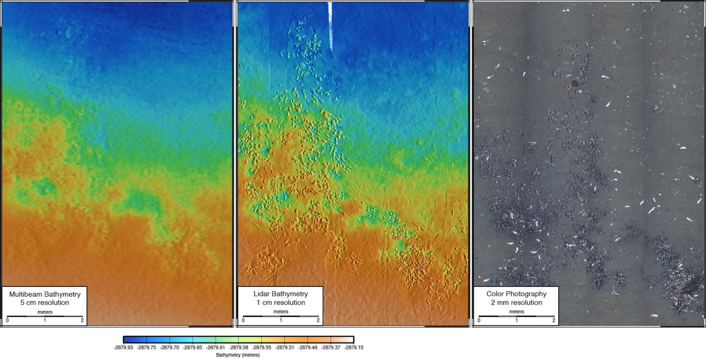
This technological roadblock has limited our understanding of ocean changes and processes for years. But that’s changing fast: The Monterey Bay Aquarium Research Institute is working with 3D at Depth to develop a lidar system capable of measuring the ocean floor at resolutions of 1 centimeter.
Once developed, this lidar system will be mounted onto unmanned underwater vehicles, where it will capture point clouds alongside color imagery for areas of 6400 square meters at time.
In a statement, Principal Investigator for MBARI’s Ocean Imaging project David Caress said, “Our desire to achieve 1-cm-scale surveys of areas with complex and rugged terrain requires generating precise bathymetry over ranges from 2-m to 20-m, while our need for efficient use of expensive platforms requires a scan rate and a field of view comparable to other swath mapping sensors. Achieving this performance with a LiDAR will enable us to make fundamentally new observations in the deep ocean in support of our benthic ecology and marine geology research programs.”
3D at Depth was last seen in the news working with FUGRO on a project that used lidar to 3D print a new part for a damaged subsea well.