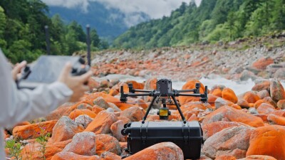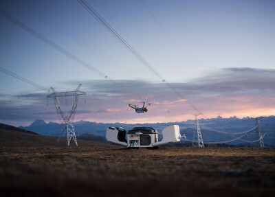
With the introduction of its new Zenmuse 3, Chinese UAV leader DJI continues to advance drone-based lidar operations. According to a statement from DJI, the system “can be integrated with DJI's ecosystem, including the D-RTK 3 Multifunctional Station, DJI Pilot 2, DJI Terra, DJI Modify and DJI FlightHub 2, “to deliver an end-to-end mapping solution.” With this capability, DJI said that the Zenmuse 3 could “expand the adoption of high-end aerial surveying LiDAR technology to more enterprise applications from topographic survey, emergency response, historical conservation, energy infrastructure inspections, and forestry.”
Ultimately, DJI asserted, the system “marks a breakthrough for DJI in long-range, high-accuracy lidar that will no doubt advance and transform the geospatial industry globally.”
Features of the new system include:
- 1535 nm lidar and a proprietary high-accuracy system: The Zenmuse L3's lidar system can achieve “a detection range of 950 m at a pulse rate of 100 kHz, tested under 100 klx ambient light and on objects with 10% reflectivity.” DJI reported that the lidar “delivers ranging repeatability of 5 mm at 150 m (1σ) and supports microsecond-level time synchronization.” Moreover, the system’s lidar, DJI said, can “accurately detect smaller objects, such as power lines and branches, with a laser beam divergence of just 0.25 mrad (1/e²).”
- A dual 100MP RGB mapping camera system: The system comes with dual 100MP 4/3 CMOS RGB sensors and a mechanical shutter. These features enable the Zenmuse L3 to offer “enhanced accuracy and efficiency” and “achieve a ground sample distance (GSD) of 3 cm, even at a flight altitude of 300 m.” What’s more, DJI stated, the system’s “dual RGB mapping cameras offer a horizontal field of view (FOV) of up to 107°, enabling each capture to cover a broader area.”
- Superior penetration capability: DJI asserted that the Zenmuse L3 can generate accurate spatial reconstructions because of the system’s “maximum laser pulse emission frequency of 2 million points per second and support for up to 16 returns.” DJI said that the system’s “penetration capability is especially well-suited for terrain mapping such as dense forests and urban environments, capturing more ground points with greater completeness, significantly improving the accuracy and integrity of terrain data for precise surface fitting and reconstruction.”
- Increased efficiency: The Zenmuse L3 can be mounted on the DJI Matrice 400 to improve operational efficiency. DJI explained that the system “can capture lidar and RGB data simultaneously to generate a range of mapping deliverables from a single flight, including digital orthophoto maps (DOM) and digital elevation models (DEM), and more – even despite a 20% LiDAR side overlap ratio.”
The launch of the Zenmuse L3 is just the latest in a series of lidar-focused product offerings from DJI. For example, last year, the company introduced the DJI Air 3S. This product was the first DJI drone to feature forward-facing lidar.
More recently, DJI came to market with its New 2 drone. An upgrade of its earlier New vehicle, the New 2 includes lidar for obstacle avoidance, along with downward-facing infrared sensors for improved safety.