

Dealing with an aging infrastructure throughout the world, governments are playing catch-up-quick on jobs put off for decades. Urgency takes precedence—what’s falling down now must be dealt with now—but that approach doesn’t make the most sense logistically or fiscally, in the long-term. Technology must help hasten the process.
With expert help, many governments are attempting to identify and remediate or replace bridges, roads and other infrastructure assets. And while technology can help with these tasks, there is no magic key that will quickly and painlessly document such assets. These problems are compounded by the issue of limited government finances, as well as the task of quantifying and qualifying the state of each asset.
Waiting until a collapse happens seems to be the default game plan for some governments, leaving many to hope the next collapse won’t be fatal. That hands-off approach is no longer an option, and one of these answers to untying this technological gordian knot is through using tools for mapping infrastructure.
Are The Tools Ready?
But are the tools up to the task? Experts say they are in part, at least. New tools are being developed, too. Drones, LIDAR, state-of-art 3D mapping systems and construction software and proprietary platforms are all part of the solution.
The recently approved Infrastructure Plan promises to be helpful in the long process of digitization, and some experts in the software as a service (SAAS) niche say such funds already have freed up agencies interested in upgrading software and adding to employee knowledge. Clearly, helping local governments to digitize infrastructure assets is the new cutting edge—promising faster and more accurate work and many savings—and reality capture is a big part of that sea change.
“I have seen a push recently to more of a digital transition,” said Brian Skripac, Director of Virtual Design and Construction at the Design-Build Institute of America.
“I think it’s more of a digital transition… Utah is standardizing digital delivery and Pennsylvania, New York, Georgia, Florida and Texas are making headway.”
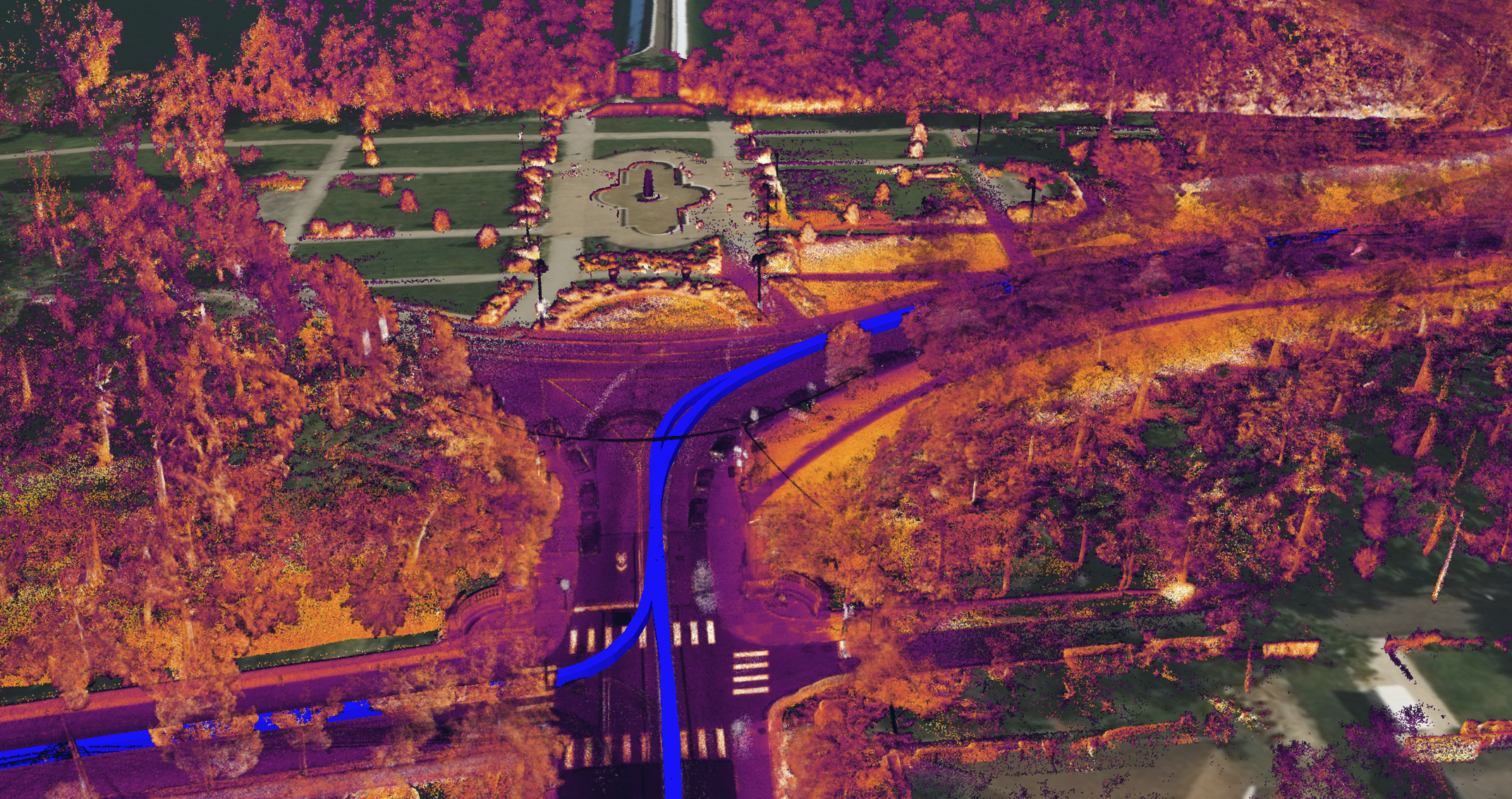
Start-ups also are seeing the great opportunity that’s part of the huge task of digitizing all infrastructure assets in the U.S. One group in Pittsburgh aims to capture the state of the city’s 450 bridges as a demonstration of its scalable platform, which is compatible with the gamut of reality capture tools and is designed to address maintenance needs of large infrastructure assets.
“The Infrastructure Bill has brought attention to our nation's degrading infrastructure problem,” said Alexander Baikovitz, Co-Founder and CEO of Pittsburgh-based Mach9 Robotics, which is mapping the bridges with its sensor-based mapping platform, an effort called the Pittsburgh Bridge Initiative.
“We view technology as a huge part of the solution to address this nationwide challenge.”
This gargantuan task of mapping all the nation’s infrastructure is more than simply getting the right drones, lidar and software, etc., and plugging stuff in and Viola!!
People need to know how to use the systems and how to make the most of the data they provide. Mach9 Robotics’ platform seems uniquely suited to help employees with any learning curve. By using its sensors to note changes in a structure over time, the tool can alert inspectors to potential problems. In this way, employees can see how the model representing the structure represents the actual asset and its changing condition. It’s sort of a technological alert system, or an extra set of eyes scrutinizing infrastructure, looking for discrepancies.
And though anecdotal evidence is what it is, hopefully, reports of Infrastructure funds helping agencies digitize are true and in fact widespread. Local governments especially need to get up to speed, with some reports giving the nation’s bridges an overall rating of a C-. The problem is dire.
“I think the challenge is two-fold, because it’s a maintenance issue, too,” Skripac said. “Do you have the team members to manage that information?... Institutionalized knowledge [often] is trapped in one person’s head.”
Also, the data provided is only as good as the info related to the points connected on a model. So that process of committing to digital memory the details of a bridge blueprint often is shuffled off by employees. That’s understandable since it’s not a painless endeavor.
To demonstrate, consider eFacility LLC, a Pittsburgh facility management software firm, which specializes in digitization of infrastructure records. The company’s process starts with a scan of an old document like a blueprint—a 2D document—and puts it in a 3D format, making it so the model can be easily updated over time.
“We have technology that allows you to use our system as if it was a model,” said Ray Steeb, CEO of eFacility LLC. The system also enables users to link back to documents that pertain to the original document, like O&M manuals and warranties on equipment. But these transitions take a lot of time—which is why consultants have entire business niches dedicated specifically to digitizing records and hyperlinking.
Getting the current details of an asset like a bridge, right now, is job enough in and of itself. Ensuring that employees who are tasked with paying attention to those details do not overlook the most crucial data is another matter. Usability of a software solution will play into whether it’s fully used, and Mach9 aims to make its highly compatible tool part of the solution.
Mach9 combines data-gathering sensor-clad ground-based and aerial vehicles to create maps of infrastructure that reflect their current state.
“By combining visual, spatial, inertial, GPS and radar data, Mach9's technology can help infrastructure operators see the unseen. The Pittsburgh Project has helped us refine our mapping technology to provide our commercial and government customers with robust, accurate, and fast insights from the built world,” Baikovitz said.
“Mach9 has built the latest in 3D mapping and geospatial computer vision software in-house, which we are actively scaling with different surveying, civil engineering and utility services firms.”


