
Virtual Reality Used to Test Worker Reactions at Job Site [Construction Dive]
German researchers are studying the behavior of employees “before and after simulated fatalities” to understand how to improve worksite safety.
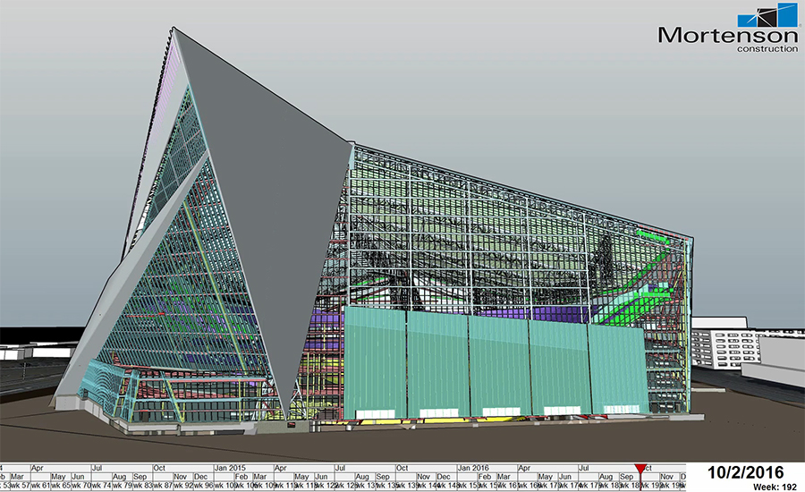
Construction Productivity Gains from Virtual Design and Construction are Finally Taking Hold [ENR]
A veteran researcher says that 3D, 4D, and VR technologies are starting to bring projects in ahead of schedule and under budget.
Five years of observations from tandem satellites produce 3D world map of unprecedented accuracy [TechCrunch]
TanDEM-X and TerraSAR-X found each other in orbit to map the whole world at 1m accuracy.
Raytheon Developing Next-Gen Human/Machine Interface for Windowless Armored Vehicles [Raytheon]
The technology uses LiDAR to create a 3D model of the environment, which is augmented with hi-def video to give the crew better situational awareness.
HP Sprout Pro 3D Scanning Review [Nick Lievendag]
HP’s Sprout puts Intel’s RealSense 3D camera in a desktop computer. Is it up to the task of professional-grade 3D scanning? Yes and no.
Seeing Beneath the Canopy: LiDAR at El Pilar [Experiment.com]
A crowd-funded project to scan El Pilar, an ancient Maya city on Guatemala’s border with Belize, demonstrates just how crucial LiDAR technology has been to its work.


