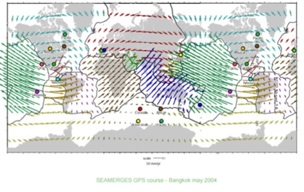
Terrestrial reference systems and reference frames define the parameters necessary to the establish coordinate systems.
A reference system is an unequivocal specification of conventions, algorithms and numerical constants. The ability to build a reference system that can be realized on a global scale is a fairly recent development. In the past there were local, national and regional systems designed to fit the portion of the earth of interest to the designer. There were, and are, hundreds of them each with their own unique combination of origin, axes, units, constants, algorithms and representations of the figure of the Earth.
However, in all cases a reference system still remains unattached to the real world. It is the office of the realization, the establishment of real positions on the surface of the Earth for it to become a reference frame. The reference system and the reference frame depend on one another–neither is useful without the other, just as positions on the Earth are useless without an origin, orientation of the axes, definition units and so on. Without a reference frame, the coordinates of control points are like chess pieces without a chess board, they can be arranged, analyzed and moved about but they have no meaning.
Since the utilization of the Global Navigation Satellites Systems has become virtually universal, the effect of temporal variations on the orientation of the Earth cannot be ignored. The surface of the Earth is in motion with respect to its center, its axis of rotation, and itself. The movement of the tectonic plates, ocean and atmospheric loading, Earth and polar tides all disrupt any idealized reference system as a result a viable global reference frame must support four-dimensional positioning. There is no absolutely correct method of measurement, and the resulting positions themselves add systematic error to the realization.
Yet the puzzle must be solved–and it has been, much to our benefit. Today, the International Terrestrial Reference Frame (ITRF) is maintained by the International Earth Rotation Service (IERS), which monitors Earth Orientation Parameters (EOP) for through a global network of observing stations. This is done with GPS, Very Long Baseline Interferometry (VLBI), Lunar Laser Ranging (LLR), Satellite Laser Ranging (SLR), the Doppler Orbitography and Radiopositioning Integrated by Satellite (DORIS), and the positions of the observing stations are now considered to be accurate to the centimeter level. Recognizing that the several hundred control stations worldwide for which it publishes yearly coordinates are actually in motion due to the shifting of approximately 20 tectonic plates worldwide, the IERS also provides velocities for them as mentioned in an earlier blog post on ITRF.


