
Two new initiatives promise to bridge the gap.
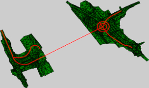
In the world of 3D data, the building interior has always been separated from the geospatial. The problem, as I understand it, is interoperability–the data you gather for your building modeling won’t always play nice with your geospatial data. This means you might not always know the exact positioning of your built assets, which is frustrating because your built assets are, of course, located in a geospatial position. I mean, where else would you put them?
Now, finally, there are initiatives under way to bring the worlds of BIM and geospatial together. Two of these major initiatives are the direct result of a collaboration between buildingSMART International and the Open Geospatial Consortium (OGC).
You probably know buildingSMART International as the organization driving the adoption of open, international standards for BIM. Recently, they’ve been working to develop what they are calling the IFC for Infrastructure Project. This project extends the Industry Foundation Classes (IFC) format, which was previously only used for buildings, to support infrastructure like roads and bridges. In other words, it helps bring BIM outdoors.
It also offers a common conceptual model between BIM and geospatial data.
The first stage of IFC for Infrastructure, and the stage that involves the OGC most deeply, is the IFC Alignment extension project. It has a number of major goals, but these are the ones you’ll want to pay attention to: they intend to enable you to “link alignment information such as cross sections and full 3D geometry of construction elements,” as well as “exchange alignment information from planning to design, to construction, and finally to the asset management phase.”
Are you looking at that smart model you spent so much time on and wondering where your construction elements are located geospatially? Over the entire lifecycle of your building OR your bridge, road, or tunnel? This project wants to give you that information.
The blog “Between the Poles” (which is very informative on the matter, if you’d like a deeper dive) says that the project will also provide a common conceptual model of road alignments for use in both OGC and buildingSMART standards.
That last bit, as you probably know, will allow you to map your IFC elements to InfraGML, a conceptual model that the OGC is developing for land parcels and the built environment.
What does this all mean? BIM and geospatial will start playing together. As long as BIM practitioners are willing to up their geospatial game, and geospatial practitioners are willing to up their BIM game. The common conceptual model is a good start, but it’s still up to those in the industry to use it properly.
Where can you find these documents? buildingSMART has released drafts of their documents here, and are asking for public comment. The OGC has released the first draft of their InfraGML model, called the LandInfra Conceptual model here.
According to Richard Petrie, chief executive of buildingSMART International, “This cooperation between buildingSMART International and the OGC will make it possible for software to directly map IFC alignment models to InfraGML and vice versa. This represents an important milestone in reaching our shared goal of vendor-neutral standards that enable integration of geospatial information and information about the built environment.”
Scott Simmons, Executive Director of the OGC Standards Program, said, “The joint coordination of OGC and buildingSMART International in developing this conceptual model is an example of the benefits of proactive engagement between Standards Development Organizations. Our working together will result in a standard better suited to both communities and we’ll accomplish this much more quickly than if we worked separately now and harmonized later.”


