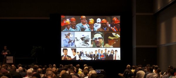
One of the keynote speakers at last month’s SPAR International was Daqri President Andy Lowery. I do not intend to cover his presentation here as Sean did a fine job of that last week. However, I do want to dive deeper into the implications of the need for a new type of worker that Mr. Lowery referred to as a “silicon collar” worker—in short, someone with technical capabilities greater than the blue collar worker but without the need for the classical education expected of most white collar employees.
In general I agree that what many of us in the 3D imaging/spatial data world ask of users does not fit the standard mold of the late 20th century. Most of us in executive positions completed university studies before laser scanners were available. In fact, most university programs are teaching with hardware that is 7-10 years out of date. I know that what I learned performing contract work during the summer months put me laps ahead of the survey department at my university. Because most of the hardware is sold as “faster, easier, and needing less man-power,” the blue collar worker has often been the person driving in the field.
Perhaps we are simply upgrading some field techs (or downgrading land surveyors) to silicon collar positions. With a lot of time and training this has been made to work but it doesn’t seem to be transferring to the client base. If there is one anecdotal line that never seems to change, it is that “the clients always fail to fully utilize the deliverable.” They may get what they need but they mostly skim the surface. I think this is because they lack a technician with the skill set(s) needed to reap all of the benefits produced by 3D data. When one looks at it this way, questions begin to arise.
My first question is about these silicon collar workers. Creating a new class of workers sounds great but is this “opportunity” actually a requirement before 3D data is fully utilized on an enterprise scale?
The term that I’ve started using for my holy grail of 3D deliverables is “spatial databasing”. The idea is that all data has a spatial component and that this spatial component should be used as the primary key when indexing any other data. When indexed this way, the 3D deliverable (point cloud, CAD model, BIM, etc.) becomes the access point for all data across the enterprise. It’s not unlike the change that occurred in municipalities when GIS was adopted in the early 1990’s. However, in that case they had/have dedicated personnel to import and retrieve data. These people do not exist in the corporate structures of most asset owners today. Perhaps these are to be the silicon collar jobs mentioned earlier. If so, we may very well have to create and foster these positions in order to foster enterprise wide adoption of spatial databasing.
I’ve mentioned the negative aspects of workplace “silos” before and I think the concept is well understood. The problem has been one of getting power brokers within a company to step out of their little fiefdom in order to work together for the benefit of the company as a whole. Unfortunately, I am finding that there are disincentives built into the system that not only discourage this but discourage proactive decision making in many cases. Getting a maintenance department to use your 3D data to improve maintenance seems like an easy sell until you realize that their workers have contracts that incentivize them to make repairs quickly. A proactive approach may increase the company’s profitability by replacing assets before they fail, but if nothing fails then no speedy repairs are needed or recorded. Thus no bonuses are paid to the maintenance guys for making speedy repairs. When you and the client starting looking for reasons to explain the failure of your system to live up to its billing, the odds are pretty low that either of you considered going to HR to review personnel contracts. In this example there were monetary incentives in place that were actively working against your success.
I could go through more examples but I’m sure you get the point. Until we have the type of buy-in necessary to look at the workflow enterprise wide we will continue to be disappointed in the pace of adoption on that very scale. Facts like these sure make the immediate future of enterprise level spatial databasing seem more like an active service than a product.