

Jonathan Coco, Forte & Tablada — Advanced Measurements and Modeling for Forte & Tablada Engineering Consultants of Baton Rouge, LA. specializing in cutting-edge methods and outside-the-box solutions for a wide range of disciplines.
After just one day of SPAR anyone could tell there was a big shift towards “flying things.” Not that there was less laser scanning, mobile mapping, and other great tech to go around, there was just an unusual abundance of aerial craft scattered about and mounted on pedestals like trophies. All an obvious marketing primer as the FAA draws closer to finalizing the long awaited UAS regulations; but, with all these drones comes a heightened sense of what photogrammetry brings to the 3D scanning industry.
There have been numerous articles that have expressed the idea that photogrammetry or structure from motion technology could somehow replace laser scanning or at least steal away a piece of its current market space. I have always felt that they each have their strengths and weaknesses, to the point that they could make a better team than rivals. Can combining these technologies, both hardware and software, be possible? At SPAR this year I noticed several cases in which the individually captured data sources were effectively combined in an effort to supplement each other. I also witnessed hardware developments in flash LIDAR (old news now) and VLS (more on that later) which effectively borrows techniques from both photogrammetry and laser scanning. Although not directly stated, this symbiotic combination of the technologies seemed to be one of the major underlying themes of the conference.
There are currently a number of handheld scanners that use some form of photogrammetric algorithms for position tracking while depth is derived from interpreting a return pattern of diffracted laser points. This was popularized by the PrimeSense-based sensors like the Microsoft Kinect and ASUS Xtion. This technology and hardware is used in a number of currently produced devices, but there are newcomers to the market that bring interesting concepts to the table.
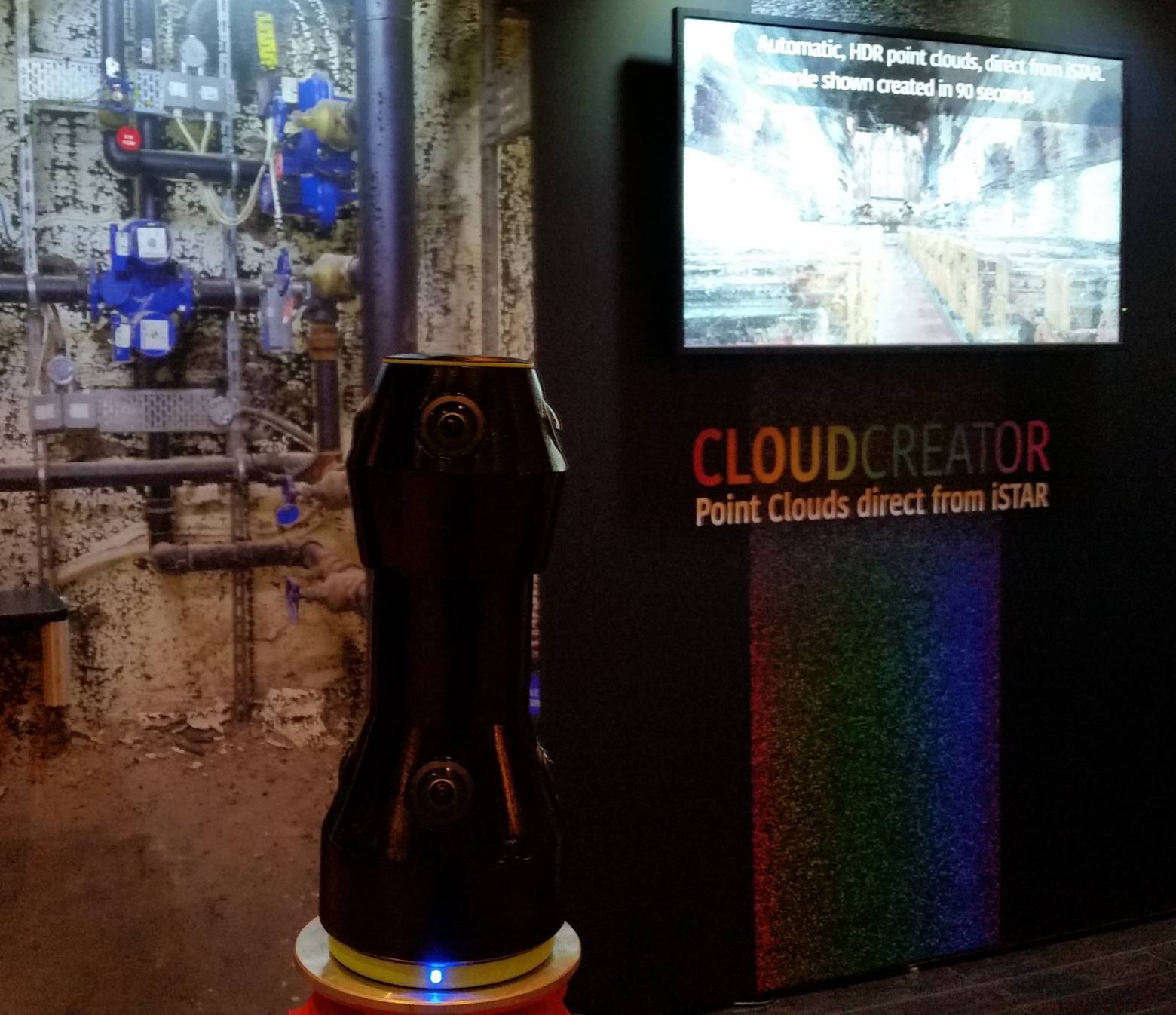
The first is a new prototyped device from the well-recognized NCTech for creating photogrammetric point clouds from a stereo pair or calibrated iSTAR cameras. The methodology is reminiscent of terrestrial scanning from a tripod, but the advantage is incredible capture speed with unparalleled imagery. I was enthralled by visual quality of their data!
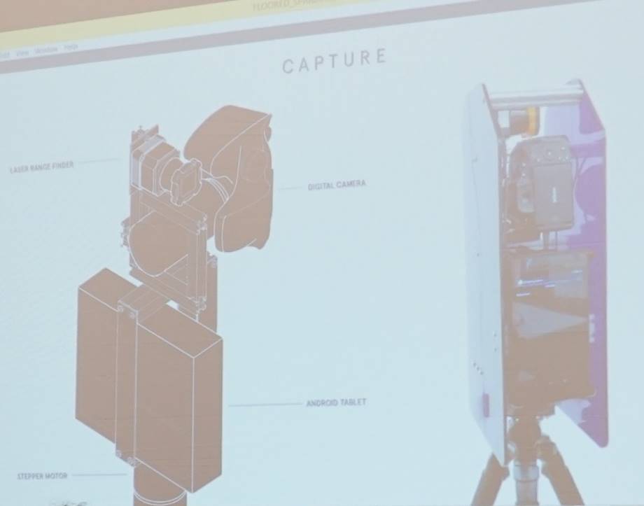
The next intriguing tech came from Floored who creates astonishingly beautiful interactive models for the real estate market. Although they have not expressed an interest in mass producing and commercializing their hardware, it looked highly provocative. Their “scanner” uses a DSLR camera, a laser profiler, and an android tablet to capture geometry and texture. Accounting for just the hardware, it appears to be a surprisingly economical package.
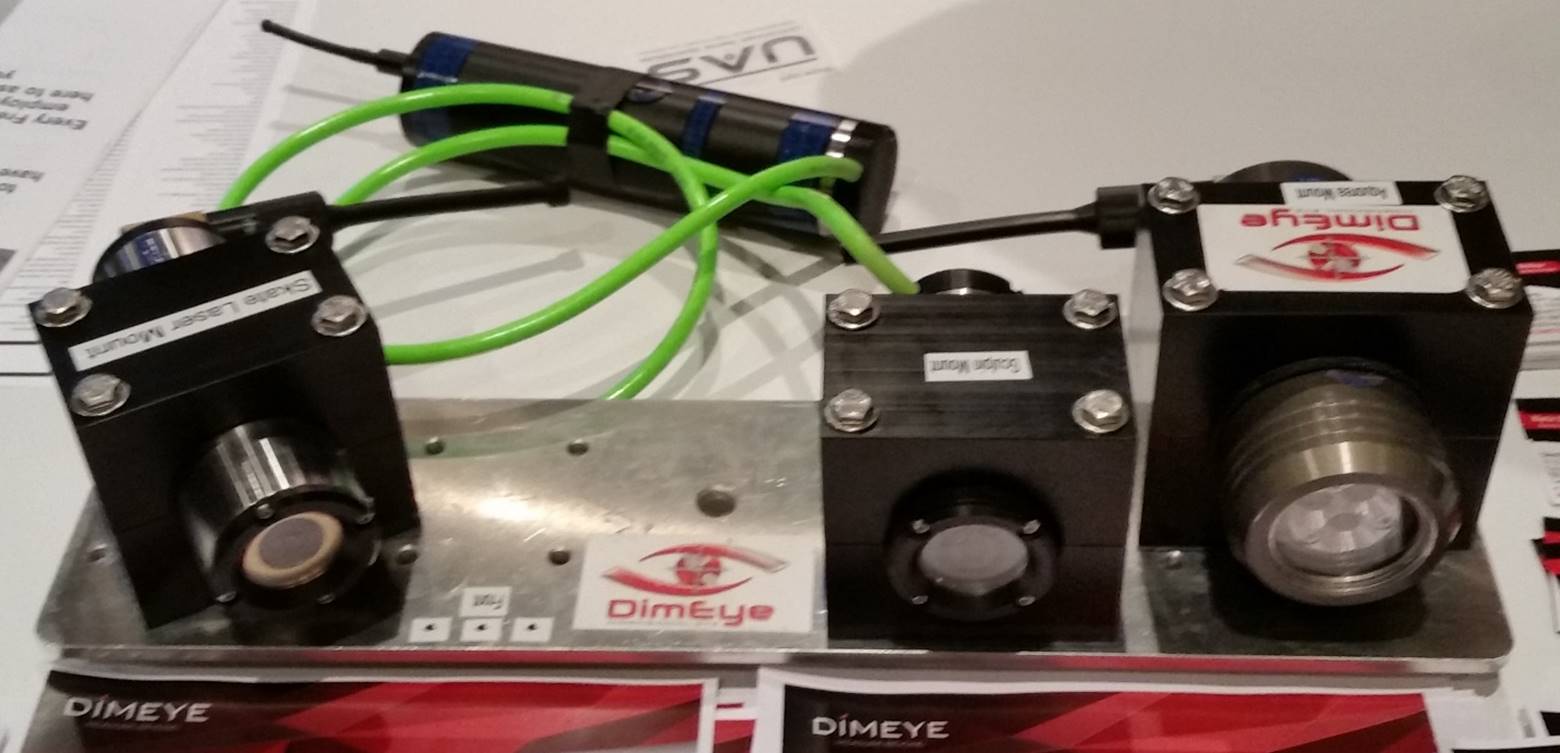
The last systems come from DimEye, who have somehow managed to combine videogrammetry and laser triangulation scanning into what they call VLS or Video Laser Scan. It is an incredibly simple yet versatile system capturing data in air and under water in clear conditions. The video from their website suggest micron level accuracy!
Elastomeric gasket scan data taken from DimEye mounted on an ROV: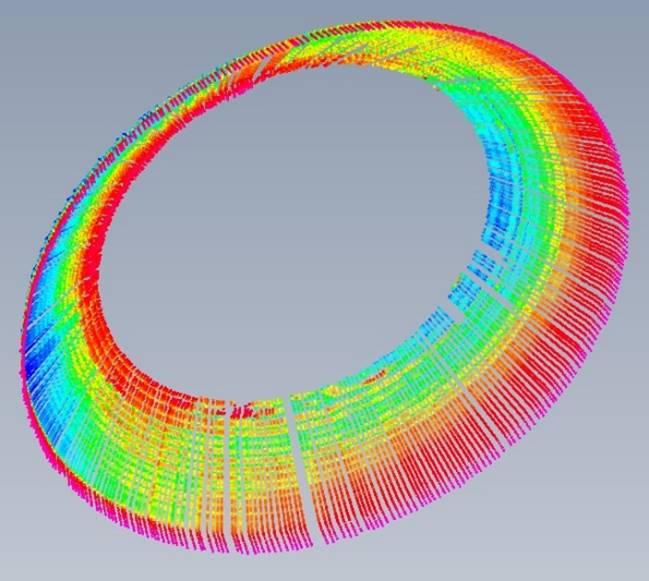
While we all expect photogrammetry to become a large contributor to 3D scanning from drones, I find it amazing how fast it is evolving and becoming integrated with laser scanning systems rather than replacing them. Personally, I will be keeping a close eye on all of them, especially on advances in flash LIDAR as it appears to be a uniquely holistic combination of the best each technology has to offer.
http://nctechimaging.com/wp/
http://www.floored.com/
http://dimeye.com/


