

Estimated horizontal change from NAD83 to new geometric datum
(from April 22, 2014 APSG presentation by Denis Riordan, PSM of the NOAA, National Geodetic Survey)
“Replace NAD83” is the first objective of the second goal in the National Geodetic Survey Ten-Year Strategic Plan, 2013-2023. In this instance the objective is the replacement of NAD83 with a truly geocentric reference frame and with that, the reduction of all definitional and access-related errors to 1 centimeter when using 15 minutes of GNSS data.
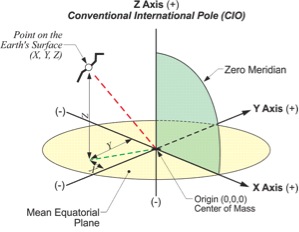
The establishment of NAD83 took more than 10 years. More than 1.7 million weighted observations derived from classical surveying techniques throughout the Western Hemisphere were involved in the least-squares adjustment. They were supplemented by approximately 30,000 EDM measured baselines, 5000 astronomic azimuths, and more than 650 Doppler stations positioned by the TRANSIT satellite system. Over 100 Very Long Baseline Interferometry (VLBI) vectors were also included. But GPS, in its infancy, contributed only five points. The result was an offset of the center of the reference ellipsoid (GRS80) by more than 2 meters from the actual center of the Earth. This fact has placed NAD83 out-of-step with the International Terrestrial Reference Frame (ITRF).
Non-geocentric NAD83
The non-geocentric aspect of NAD83 is one reason it will be replaced. There are others. Because there is no method of tracking the motion of passive marks, i.e. concrete embedded brass caps, NGS cannot maintain consistency between the active stations (CORS) and the passive. Divergence between them is virtually assured. As a result passive control will not be a component of the new datum though it will be tied to it.
Estimated ellipsoidal height change from NAD83 to new geometric datum
(from April 22, 2014 APSG presentation by Denis Riordan, PSM of the NOAA, National Geodetic Survey)
“Replace NAVD88” is the second objective of the second goal in the National Geodetic Survey Ten-Year Strategic Plan, 2013-2023. In this instance the objective is the replacement of NAVD88 with a true four-dimensional geopotential field that will be capable of describing the gravity field, heights and deflections anywhere on or near the Earth. This includes the reduction of all definitional and access-related errors in orthometric heights in the geopotential reference frame to 2 centimeters when using 15 minutes of GNSS data. Note that vertical control will be available through GNSS and a geoid model without reliance on published heights on passive geodetic bench marks.
As was mentioned earlier instead of fixing NAVD88 to 26 tidal stations the latest adjustment was constrained to only one. That station is Father Point/Rimouski, a station on the southern bank at the mouth of the St. Lawrence River. Unfortunately, the NAVD88 zero height is biased by approximately 50 cm from the latest, best geoidmodels provided by GRACE satellite observations. The same satellite data has revealed that NAVD88 is tilted by approximately 1 meter across the continental United States. Add to that the lack of maintenance and the constant disappearance of passive benchmark monuments and it is clear that NAVD88 as it stands is not sustainable.
In the meantime, the use of GPS and constrained least squares adjustment in height modernization efforts will continue to propagate NAVD 88 bench mark heights tonew marks. However, these strategies do not solve the root problems of the vertical datum. That will be accomplished by the replacement of NAVD88 with a geopotential reference surface.
More information is available on these and other aspects of tem-year plan here:
http://www.ngs.noaa.gov/web/news/Ten_Year_Plan_2013-2023.pdf


