

When asked what equipment on a rural facility site should be captured, the most common answer is, “Everything!” Leaving aside that this is seldom (if ever) the actual requirement, it is true that scanning is most often the fastest and most efficient method to collect the data that does need to be gathered. As you know, where LiDAR collection results in a point cloud that reveals the shape, size and (usually) the relative location of each piece of equipment. A great deal can be accomplished with this information, but it is often not enough to adequately answer the simplest question about a feature: “What is it?”
The most commonplace things are identified without trouble, of course. The access road into the facility, the barbed wire fence around it and the cattle guard at entrance can all be recognized immediately. In fact, there are even online services that will correctly categorize such objects from a photograph—sometimes. However, less prosaic features are not so easily classified, at least not at the level of detail the client requires.
For example, here is an image from a point cloud. What is it?
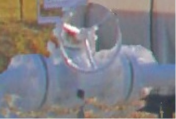
Perhaps you recognize that it’s a valve. Deriving more information than that is difficult from the point cloud. And there may be several pertinent questions. What type of valve is it? What is its function? Who manufactured it? What is the grade of material from which it was made? What is its ANSI class? What is its maximum working pressure? What is its temperature rating? These questions may be why the client needed to have the 3DLS work done in the first place. If the information cannot be had, if it cannot be tied directly to this piece of equipment, then its shape, size, and relative location are likely to be much less useful.
A better image might help make things clearer. Here is a photograph of the same piece of equipment.
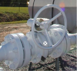
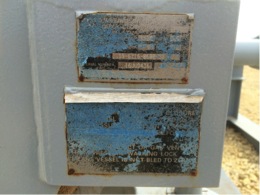
It is still difficult to answer detailed questions about it. The image search engines available online are not much help, but there is something in the image that does provide the answers. Here it is:
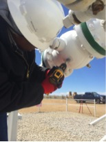
It is the manufacturer’s tag attached to the valve. It confirms that it is a 4-inch ball valve ANSI Class 600 manufactured by Balon. Its maximum working pressure is 1480 PSI and its temperature rating is -50 to 250 F. The tag supplies much more information, too.
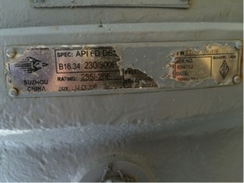
However, in order to include this information in the deliverable it is necessary to somehow extract it from this tag and attach it to the shape, size and the relative location of the valve, information gleaned from the scan. Unfortunately, building the data path from acquisition in the field to a combination of attribute and scan data that will be delivered to the user can be difficult. For example, manufacturer tags are frequently painted over and the paint must be removed to make them readable. Hot work permits may be necessary under some circumstances.
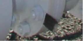
The tags are often damaged or obscured.
It is tempting to say that it is not necessary to go through all this trouble. Instead of relying on collection of this information in the field, surely that information was included in the design of the facility; or surely there is a schematic, a process and identification drawing that includes that information; or surely the information is in the supply chain data. In other words, there must be other sources from which attributes can be collected without reading every manufacturer’s tag in the field. Unfortunately, even when these sources are available, correlation of their attributes to the actual equipment in the field is most often problematic and uncertain. They do not prove to be as complete and reliable as field data collection.


