

Laws governing licensure in the surveying and engineering part of the geospatial realm often say their primary purpose is to protect the public. They underline that the public has a right to expect that their faith in the expertise and work products of a geospatial expert be justified. Fortunately, the client most often receives data that is fit for purpose and all is well. Unfortunately, it is also quite easy for an uninformed client to push that data beyond its limits and use it in applications it cannot support. When this happens, outcomes can be dire.
The best way to prevent such misapplication is to ensure that the data’s accuracy and reliability are both known and communicated at the time of delivery. I suggest that communicating this vital information is a fundamental responsibility required by the trust afforded us.
In my last post, I suggested that comparing one geospatial dataset to another when the reliability of both are undefined in the first place does not establish the correctness of either data set. However, the same cannot be said when one of the datasets involved is of properly verified higher accuracy. In fact, this is the essence of the recommendations in the Federal Geographic Data Committee (FGDC)’s Geospatial Positioning Accuracy Standards Part 3: National Standard for Spatial Data Accuracy for evaluating accuracy. It states:
“The National Standard for Spatial Data Accuracy (NSSDA) implements a statistical and testing methodology for estimating the positional accuracy of points on maps and in digital geospatial data, with respect to georeferenced ground positions of higher accuracy.”
The standards offered by the NSSDA are valuable because they provide a foundation on which geospatial accuracy and reliability can be authoritatively stated. They can also be directly pertinent for those performing federal work. According to Executive Order 12906,
“Federal agencies collecting or producing geospatial data, either directly or indirectly (e.g. through grants, partnerships, or contracts with other entities), shall ensure, prior to obligating funds for such activities, that data will be collected in a manner that meets all relevant standards adopted through the FGDC process.”
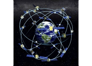
The NSSDA standards mention the Global Positioning System (GPS) as a source from which the high accuracy control required for its methods can be derived. In most circumstances, GPS is preferred for establishing the georeferenced ground positions with the superior accuracy needed. Properly used, the technology is remarkably reliable. However, too often the output from a GPS receiver is accepted without question. When the use of the technology transforms a garden-variety coordinate into an incontrovertible fact by its very use, something is wrong. When the utterance of “I GPS’d it,” is supposed to sweep aside any question of the truth of the result it begs the question, “Just exactly how did you GPS it?”
The ubiquity of receivers and the ease with which they can be operated has led, inevitably, to uninformed button pushing. In a car navigation system, a smart phone, or a sport fish-locator, there is hardly any harm in that. In the work of a trusted geospatial practitioner, there is.


