

You know, sometimes the military really does have the coolest toys. This is simplistically stating it, but while our industry is ogling software that automatically identifies pipes from point cloud data, the Navy is using lidar to automatically detect specific pirate ships. Talk about a great use of the technology.
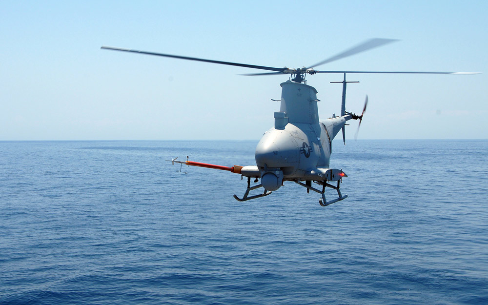
Specifically, drone helicopters (more of those unmanned aerial vehicles that are all the rage nowadays) are being equipped with lidar, and then flown out over pirate-infested waters (don’t laugh – piracy is a big deal right now) to hunt down rogue vessels.
Which is not to say this is happening RIGHT NOW:
The U.S. Navy plans to upgrade its robotic Fire Scouts with electronic “brains” that are able to automatically recognize small pirate boats spotted through 3D laser imaging.
Note the word “plans.” They’re going to test the system starting this summer with a gaggle of small boats off the California coast. But all of it does, indeed, make sense:
“The automatic target recognition software gives Fire Scout the ability to distinguish target boats in congested coastal waters using LADAR, and it sends that information to human operators, who can then analyze those vessels in a 3D picture,” said Ken Heeke, program officer in the Office of Naval Research’s Naval Air Warfare and Weapons Department.
It’s also always nice to hear this kind of endorsement of 3D data capture as a basic principle:
“Infrared and visible cameras produce 2D pictures, and objects in them can be difficult to automatically identify,” said Dean Cook, principal investigator for the MMSS program at the Naval Air Warfare Center Weapons Division. “With LADAR data, each pixel corresponds to a 3D point in space, so the automatic target recognition algorithm can calculate the dimensions of an object and compare them to those in a database.”
Our SPAR marketing people couldn’t have said it better themselves. Why use 2D data when 3D data is so much better? (You know, other than the staggering difference in file size.)
I can foresee some issues here, myself. The use of video analytics has long been lauded for its ability to automatically detect things and people of interest, but its efficacy has yet to really come of age. It might be harder than they’d think to get one-to-one matches with specific boats, even using 3D data. I can only imaging the havoc the water will play with the lidar, the reflective nature of many metal boats, the fact that the helicopter is moving like crazy as it captures the data, and the just plain awesome data transfer rate their cellular transmissions must have if they’re streaming back point clouds.
What could possibly go wrong?
Still, it’s great to see the Navy investing in laser scanning and trying to figure out applications. If their system works, it seems like something similar could have really interesting applications for law enforcement on land, maybe even for search and rescue.


