

At its core, laser scanning’s selling point is its precision. The ability to measure exactly the way the world is. Much of what we do here at SPAR is look around for ways in which that ability to know can be useful. Today, I came across a story where it, unfortunately, might cause some people struggling to make ends meet to have to cut a check to the insurance industry.
But maybe that’s a good thing?
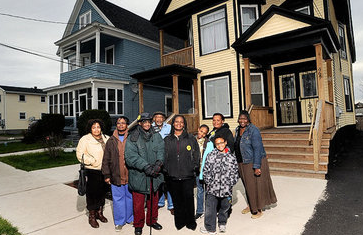
Really, I hate to hear about a battle between Syracuse’s local officials and FEMA. There’s no reason why our respective government agencies shouldn’t be able to work in conjunction to help the people who pay their salaries, but this is basically how it’s going down: FEMA put out a new flood zone map two years ago that added a bunch of properties to the zone, essentially upping their insurance bills by anywhere from $240 to $1,260 a year, as they’re now required by law to have flood insurance. Lots of people complained. The city decided to spend a bunch of money to try to get it more right.
How did FEMA create that new flood map? Well, yeah, they used lidar. They now know more precisely where the water is going to go, and they know more precisely which homes and properties are in danger.
A decade ago, Congress gave money to FEMA to remap flood zones across the country using far more advanced technology. In Onondaga County, the agency used new topographical data from a technique called Light Detection and Ranging, or LIDAR.
The technique involves flying a plane over an area and shooting laser pulses to the ground that bounce back to a computer in the plane. It is able to measure the contour of the land to within six inches, according to Mary Colvin, FEMA’s regional chief of floodplain management and flood insurance.
The city hired C&S Engineers to prove FEMA had it wrong (or at least not right enough), trying to keep as many parcels out of the zone as possible. This is, I believe, what’s called serving your constituency. (Or pandering to voters. Whichever.) But what they did was spend $18,000 to remove 106 properties from the flood zone, many of which belong to the less fortunate in the Syracuse area. Now they’re spending more to try to make a better case that the zone is even smaller.
Again, I’m a big fan of precision. Let’s get it exactly right. But even the city acknowledges this might not be the best practice in the long run:
Mihal stressed that the city is not trying to take properties out of the flood zone if the science shows they truly belong there. That would give a false sense of security to homeowners and relieve them of the requirement to buy flood insurance they actually need. And he said that although the city could take measures to reduce the flood threat around the creek, entirely removing it would be prohibitively expensive, if not impossible.
It’s not just a false sense of security. It’s risk. If the data shows the flood is probably going to swamp your house the insurance is probably worth it. That’s why FEMA and feds made the rule in the first place. Now, if you’re leaning toward the libertarian side of things, I can see the argument that people ought to be able to take the risk if they want to – hey, it’s their house that’s going to be destroyed. But FEMA’s argument is likely that your governor is probably going to ask for federal assistance to get you back on your feet, folks, when it does flood, and FEMA would rather the insurance companies pay to fix you up than taxpayers from all over the country.
Regardless, what’s important here is that 3D data is letting people make better and more informed decisions. It might hurt a few folks in the wallets, but if everyone’s doing their jobs right, it might just be a short term loss that leads to a long-term gain.


