

A few weeks back, we reported on an ambitious project initiated by the city of Troutdale, Oregon, whereby they intended to capture via mobile laser scanning their entire city in a single day. Recently, Christine Cooley Amedzake, the GIS analyst for Troutdale who initiated the project, gave me a little update.
Her experience is probably not unlike that of many people who work with huge amounts of scan data for the first time: Initially disappointing. The graphics card in her work station just couldn’t handle it, and so her plans for diving right into the data were thwarted and she was forced to wait while she went through the process of requisitioning a station that had enough horsepower.
Or, as Christine put it, “Ok- my graphics card has arrived, I can see things from the scan now. Hooray!”
I’m not sure that message can be put out there enough: If you want to play with millions of points, you need a computer with some get-up-and-go. Like 32 GB of RAM. A top-of-the-line processor. Etc. Your laptop isn’t good enough.
Anyway, she also sent along a couple of slides she used to let the higher-ups know what she’s been up to.
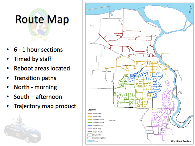
Here’s the map they put together for scanning the town:
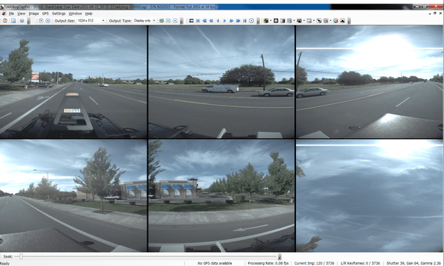
Here’s what some of the images captured by the ladybug on the top of the Topcon IP-S2 system look like:
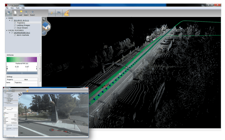
And here’s a sample point cloud, with some data associated with it:
All in all, Amedzake remains happy with the project, even if it took a little longer than she wanted to dive in. It still has only taken a little more than $10k to acquire the data and work with it ($5k for the scanning services, $5k software investment, a touch more for the graphics card), and Troutdale owns all the data and has a complete picture of where the city stood in the summer of 2011, which will return value for some time.


