

Susan Smith, managing editor over at AECcafe.com has a very thorough overview of what went on at the recent GeoDesign Summit, hosted by ESRI. For the 3D imaging professional, there’s a lot to digest, but I think the most interesting piece comes at the bottom of page 2, linked to above.
Essentially, as green design becomes ever more important to the AEC community, there will be ever more emphasis on reuse and rebuilding and renovation, which is where 3D data capture will be vital.
Smith sets the stage this way, using facilities management as an entry point:
Stu Rich CTO PenBay Solutions talked about “Taking GIS Inside Buildings – Facilities Management and Analysis” at the Summit.
Rich asked the question, why GIS for facilities?
“We’re seeing tremendous growth in urban environments, tremendous building boom, and witnessing the greatest migrations of humanity the world has ever seen,” said Rich. In 2000, we became a predominantly urban species; more people for the first time were living in urban environments than in rural. “It looks like we are going to be doing this for a longer time. This takes pressure off our agricultural lands, but the implications for urban infrastructure are profound.”
Rich pointed out that 48% of emissions are due to the consumption of raw materials for construction materials. ”The greenest building is the one we never build.”
“We need to think about how to address that existing building stock which is unlikely to have the BIM data sets we’ve been talking about,” said Rich. “How do we apply geodesign to that problem?”
Obviously, BIM is much easier when you’re starting with a brand-new building. With a brand-new building, every wall can be designed as completely straight, every corner 90 degrees (or however many degrees you want it to be), every floor completely flat. The model is reality because the reality doesn’t yet exist and you can use the model to shape reality.
However, BIM for existing structures means a lot more than just taking the original architectural drawings and creating a 3D model. You’ve got to account for the wear and tear of years of use. Floors sag. Walls shift. Things lean. Buildings breathe and live.
Trust me. I live in a 1870s farmhouse. Just to put a bookcase flat up against a wall I’ve got to wedge 10 quarters under the front to corners. There isn’t a 90-degree corner in the place.
So, paramount will be the job of collecting the actual as-built data and incorporating it into these new BIM models so that renovations and reuse projects can take advantage of what the reality is before actual work begins.
Essentially, scan-to-BIM will become more and more important as this push for reuse and rebuild continues. But scan-to-BIM isn’t easy. The workflow of the scanning might actually be the easiest part, with the processing of the data and the modeling being the time-consuming piece, as we saw in Steven Couwels’ presentation at SPAR Europe.
Rich continued at the GeoDesign Summit:
Public safety committees need to understand the inside of buildings, said Rich. And they have spatial data infrastructure that needs to be repurposed.
Rich proposes taking the visualization and analysis tools that GIS gives us, the conceptual tools of geodesign and apply them across the facility lifecycle. Extending geography into the 3D environment of offices and space is the way to go.
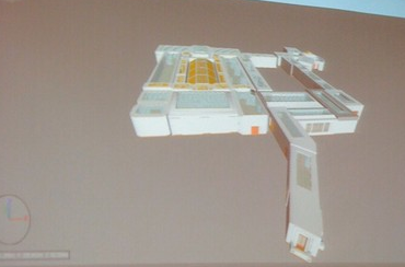
He showed data of the Esri campus gathered with a mobile lidar unit, that gathers floor space as it goes. Harvesting from CAD and BIM is better, he said, if you have it.
This integration of GIS and 3D data is vital, I would agree, but I’m not sure if I agree about the harvesting from CAD and BIM being better. That will only get you the reality of the initial design, not the reality of the actual environment. If we’re talking about public safety, especially, it’s necessary to know what’s actually in the building. How many renovations are made and not documented, walls torn out, moved, modified? Especially for buildings that are important to the public interest – hospitals, airports, those places where the public congregates often – periodic scans to document the actual as-built conditions may become commonplace.
The solution for doing the work, from scan to model, is still being developed.


