
Big Data, from the Executive Suite to the Factory Floor
“Big data has enthralled and enraged over the last four years, and no matter how you use it, plenty of questions still remain. Here are five to consider before implementing a big data update.”
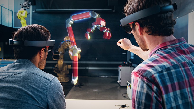
Mixed Reality is the Latest Thing, Or is It?
Is mixed reality a new technology like Microsoft says it is—or is it just a shiny new term for augmented reality?
Once everything has a sensor attached, the augmented reality headset is going to become the command center. Imagine having all the data compiled and analyzed for you in a dashboard view—just like Iron Man Tony Stark.
Google’s New Satellite Imagery Will Help Mapping Researchers
Google has updated Google Earth with a huge data set acquired by NASA and the USGS—the result is more accurate information for researchers.
In Defense of Traditional 3D Laser Scanning
“Many users [of 3D technologies]have made two pernicious assumptions, first, that all reality capture is equal, and second, that it’s as simple as taking photographs. This thinking makes room for swindlers to sell bad services and for users to find themselves with unmet expectations.”
What Space Archaeology Can Tell Us About Cities, Past and Present
What satellite and LiDAR imagery from sites like Angkor and Petra can teach us about the future of our own cities.
augmented + virtual reality platforms to help creatives visualize ideas beyond two-dimensions
“As hardware becomes less and less expensive, these platforms are unfolding across slowly, but very few people[…] have a practical vision for what the development road map might look like.”


