

Regular readers of my blog should hopefully notice a trend when it comes to commentary about UAV lidar systems. When UAV lidar systems first came to market, often using sensors repurposed from other applications, drone operators became very excited about collecting point clouds. This excitement has extended to users of UAV data, where some have assumed that a point cloud collected using UAV lidar “has” to be better than a point cloud collected from any other method.
The reality is that the characteristics of point clouds can vary dramatically depending on the system used. There are still many types of projects where a photogrammetric workflow is not only cheaper but better, too. Nevertheless, there is an increased understanding in the market that while UAV lidar does not necessarily provide cost savings, survey-grade UAV lidar provides an excellent means to undertake projects that may not have been possible previously.
Projects suitable for lidar
There are three types of environments where UAV lidar will enable projects to be delivered that may not have been possible previously. These projects include those that:
- involve steep topography,
- involve a linear-based survey, and, ultimately,
- are on sites covered by dense vegetation.
Undertaking surveys in steep areas and along linear routes is made possible because lidar surveys are active methods of remote sensing that always uses direct georeferencing. These characteristics minimize the number of control points that need to be used, especially in environments where it is either too expensive or impossible to place ground control points.
That said, the main reason to use lidar is because of the technology’s ability to collect data between the vegetation canopy. Being able to isolate the first and subsequent return from each light pulse emitted by the lidar helps us differentiate ground from vegetation and filter the dataset accordingly.
Airborne lidar systems only scan the ground
Lidar has been used for manned aerial surveys for twenty years now. For almost as long, airborne systems have been focused on collected data where it is needed; on the ground. Then relatively light 360-degree sensors (such as Velodyne’s Puck), have made mobile scanning possible for any type of platform, including UAVs.
Originally designed for automotive markets, they can also function from a UAV platform, and that functionality has led to the proliferation of 360-degree sensors on drones. Aside from being used on one of the hybrid systems that are marketed as being suitable for both mobile and UAV applications, what use does a 360-degree sensor have on an airborne UAV? After all, as we learned from Lewis Graham at ILMF a couple of months ago, for UAV mapping we really should only be concerned with those points that are within a 90° swath of the sensor. Further away from this window, returns become less reliable, or simply redundant.
Developments in airborne UAV lidar
What prompted this article was news from two lidar manufacturers best known for producing airborne lidar mapping systems who are now turning their attention to the ground-up development of UAV lidar sensors specifically designed to meet the requirements of airborne mapping.
At ILMF 2018 we saw the Riegl miniVUX-1DL, which as indicated by the ‘DL’ acronym, is a downward-looking sensor. Operating a circular scan pattern within a 45° field-of-view, with waveform digitizing and the ability to collect multiple returns, this is a sensor focused on collecting data along vegetated corridors.
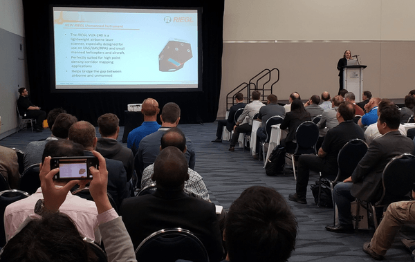
If we refer to the types of projects where UAV lidar provides the most opportunity, where the characteristics of Riegl’s miniVUX-1DL might seem restrictive could be in the survey of steep topography. At Intergeo last year we saw the launch of the Riegl VUX-240, with a high scan frequency and 75° field-of-view. This wider field-of-view may extend the range of projects undertaken by professional airborne survey professionals.
Then at this year’s AUVSI XPonential event in Chicago, Teledyne Optech entered the UAV market with the launch of the CL-90. Another downward-looking airborne UAV specific sensor, in addition to collecting up to four returns per signal, Teledyne Optech’s offering exhibits a sawtooth scanning pattern with programmable field-of-view (64°-90°), repetition rate and scan frequency. These are characteristics that permit the user to control scan patterns, data volumes, and optimize flight planning. All of these capabilities can bring tremendous benefit to the efficiency of a survey project.
What opportunities will specialist airborne UAV lidar sensors bring?
While it’s no surprise that the principle airborne lidar manufacturers are now designing UAV sensors that are optimized for airborne mapping (by simply focusing downwards) it is perhaps a surprise that it has taken this long for the industry to move in this direction. UAV lidar has now been in use for a good 5 years, but it has taken this long for both service providers and customers to realize that simply mounting a lidar onto a UAV is not a means to dramatically cut costs in and of itself. It has taken this long for the UAV industry to truly appreciate the differences in the point clouds produced by different sensors and to understand the implications that design can have on survey efficiency and back-office processing cost.
What we saw at this year’s ILMF is that the characteristics of higher-end systems are being recognized, and service providers are approaching projects with these systems not just because they are cheaper. Many providers have realized that the goals of specific categories of projects might not be achieved in any other way. Of course, no technology evolution can enable benefits in isolation. Considering other project costs and viabilities, we need to see continuous evolution in operating environments too. No matter how advanced the sensors become, in the context of corridor mapping applications there will still be limitations. Meanwhile, regulations such as those related to beyond visual line of site (BVLOS) remain rather restrictive.
As Teledyne Optech’s Director of Business Development, Martin Flood, explains in the marketing video that accompanies the launch of the CL-90, his personal view is that the sensor is used by customers ‘to do interesting things and tell interesting stories’. Whether the improved characteristics of this new breed of airborne-focused UAV sensors are used to identify unknown archaeological remains in the dense forests of South America or assess the risk of rock-fall along railroads in the Rocky Mountains shouldn’t be our focus. Instead, we have to understand and highlight the socio-economic value of being able to collect that information that will ultimately dictate how UAV lidar technologies are being adopted in the marketplace.


