

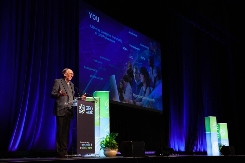
Last week in San Diego, California, Esri held their 43rd annual User Conference. The event has grown from just a few GIS professionals meeting on a yearly basis this year’s massive event, which hosted 18,000 attendees live in San Diego with another 20,000 joining in to watch sessions remotely throughout the week, with 130 countries represented overall. I was among the 20,000 joining from afar, missing out on the networking and just general conversations about the industry that come with the benefit from attending a conference like this in-person, but still was able to watch speakers and panels discuss the Esri and ArcGIS ecosystem, and the ways in general in which GIS is shaping our world.
The week-long event kicked off on Monday with three plenary sessions covering wide swaths of the GIS world. The first was hosted by Esri President and Founder Jack Dangermond, showing the ways GIS is helping to build a better world and handing out some awards to those embodying that idea. As the week went on, there were a wide variety of sessions covering different applications of GIS as well as rundowns of how to use different Esri offerings for professionals at every skill level. With such large number of offerings it was of course impossible to get a taste of everything available during the event, but by attending sessions throughout the week there were three key themes that came out about Esri specifically and the GIS and geospatial worlds at large.
Sustainability
Sustainability and slowing the effects of climate change are at the heart of conversations across industries, but this year’s Esri User Conference really hammered home the crucial place the geospatial industry holds in this battle. The theme of the entire week was Create the world you want to see, and it was an idea hammered home by Dangermond throughout his plenary session. He talked about the importance of seeing the entire world as one single ecosystem, and the idea that “sustainability starts with geography.”
We see throughout the industry all of the different ways recent innovations are helping to reduce carbon footprints and measure carbon in all sorts of ways. Satellite imagery is becoming more accessible than ever, providing unprecedented data about our planet. Construction technology companies are providing ways to measure carbon throughout projects. Even things as simple as remote tools allow organizations to reduce their carbon footprint by simply reducing travel.
And more to the theme of this show, GIS plays a big role. Dangermond let all of the professionals in the room know their role, telling the audience, “GIS professionals have an important role in creating a sustainable world.” He talked about GIS being a “foundation for progress,” providing crucial spatial context to organizations of all sizes to help better understand how and why things are happening to in turn lead to better responses.
It wasn’t just that kickoff plenary which hit on these themes, either. Many of the sessions talked about organizations using the ArcGIS ecosystem to improve their sustainability record. In the final plenary on Monday, Dr. Steven Boyes spoke about his work in Africa with National Geographic’s Okavango Wilderness Project and preserving key water sources in the Angolan highlands.
Later in the week, Dangermond also held a press conference with Dr. Richard Spinrad of NOAA and Richard Bevan of the UK Met Office in which they talked about the ways Esri has assisted these government agencies in better measuring and understanding what is happening in our environment to spur new strategies and methods of being more ecologically friendly. It’s impossible to touch on all of the ways sustainability was addressed throughout the week, but it was certainly a major presence throughout the five-day event.
GIS in 3D
The geospatial world has been rapidly transitioning towards more 3D workflows in recent years, and Esri is no exception. This was once again a part of Dangermond’s opening plenary, in which he noted that “GIS is becoming 3D.” Long an industry based on two-dimensional maps with many layers, new technology has made it easier than ever to visualize these spatial elements in three dimensions, which in turn is simply an easier way for humans to understand that context. This trend was a focus throughout the week as well, with multiple sessions focusing specifically on how to use 3D workflows in ArcGIS products and how to maximize value when doing so.
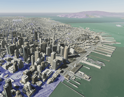
Diving deeper into the world of 3D, there was also focus on the even newer trend of leveraging gaming engines to render and stream 3D models in the geospatial industry. It’s a trend we discussed here at Geo Week News as something to watch in 2023, and something that is only growing more popular in the industry, as we discussed with Rory Armes of Unity. Using GIS data as a base layer in large-scale digital twins is common practice for people like urban planners, and there were examples throughout the week of how these visualizations can become even more powerful with the help of these gaming engines.
Involving everybody
The idea of getting multiple people involved came through all week as well, with that idea taking different forms. For one thing, a lot of the product-focused sessions throughout the week focused on allowing more team members to access data with collaboration tools. For ArcGIS Enterprise, for example, there was discussion around the product’s ability to be customized in order to break down silos within an organization, with similar sentiments being shared in a session about ArcGIS Urban as well.
It’s not just collaboration between stakeholders, though. It’s also just getting more people involved in this work who previously wouldn’t, an idea also taking a couple of different forms. A session about ArcGIS Indoors talked about the “new and emerging” field of indoor GIS, utilizing CAD and BIM floorplans to create an informational model. People in this field wouldn’t traditionally think of themselves as GIS professionals, but that is changing.
There was also talk about increasing diversity in the geospatial industry, preaching the importance of different groups being involved in this crucial field. Dr. Paulette Brown-Hinds, for example, was honored during the first day of the event for her work as a publisher of Black Voice News and her work with Mapping Black California, a geospatially-focused initiative throughout the state.
The importance of the geospatial industry was hammered home throughout the week, holding the key to a sustainable future, with new innovations making that work easier and more powerful, and getting all communities involved to solve what is a truly global issue.


