

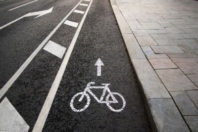
Maintaining high-quality roads is a crucial task for governments at all levels, whether it be on a national level to ensure the smooth passing of commercial vehicles, or on a local level to enable safe and easy travel for citizens. On top of that, for the latter example in particular more attention is being paid to alternative transportation methods in recent years like biking and walking with the aim of reducing carbon impacts of travel, meaning bike lanes and sidewalks need to be as well-maintained – or at least close to it – as our roadways.
One of the companies at the forefront of providing the tools to keep up with these necessary inspections is XenomatiX, whose true solid state lidar systems have been mounted to vehicles and used to monitor working roads and those under construction.
Recently, the company hosted a webinar on Geo Week News, entitled Revolutionizing Bike Lane Management: Unleashing the Power of Digital Twins for Enhanced Efficiency and Safety, specifically looking at their new XenoBike product, specifically designed for bike lanes and sidewalks, which they also spoke to Geo Week News about at Geo Week 2024. Speaking at this webinar, for which you can still watch a full recording, was the company's Head of North America, Jacopo Alaimo, and CEO, Filip Geuens.
Before getting into the products and workflows around monitoring bike lanes and sidewalks, Alaimo began the webinar by diving into XenomatiX’s main products to monitor roadways. Most of that discussion highlighted the company’s “6D Road Lidar System,” the technology on which their main products are based. At its core, the six dimensions here are the three-dimensional geometry from lidar, two-dimensional imagery from the camera system, and then an extra dimension for reflectivity to detect road markings.
Alaimo also discussed the software side of things and how users are able to visualize and analyze the data collected with 6D system. He noted that the data can be imported into any GIS software as well as Pavement Management System (PMS), and the resulting data is color-coded. Looking at individual roadways, users can see a color spectrum on which green is the average elevation of a road, with blue being lower – indicating things like potholes – and red being higher. Zooming out, users can see larger areas with color-coded roads based on the overall quality of given sections, ranging from green for good, to yellow for okay, to red for bad, and black being the bottom of the scale.
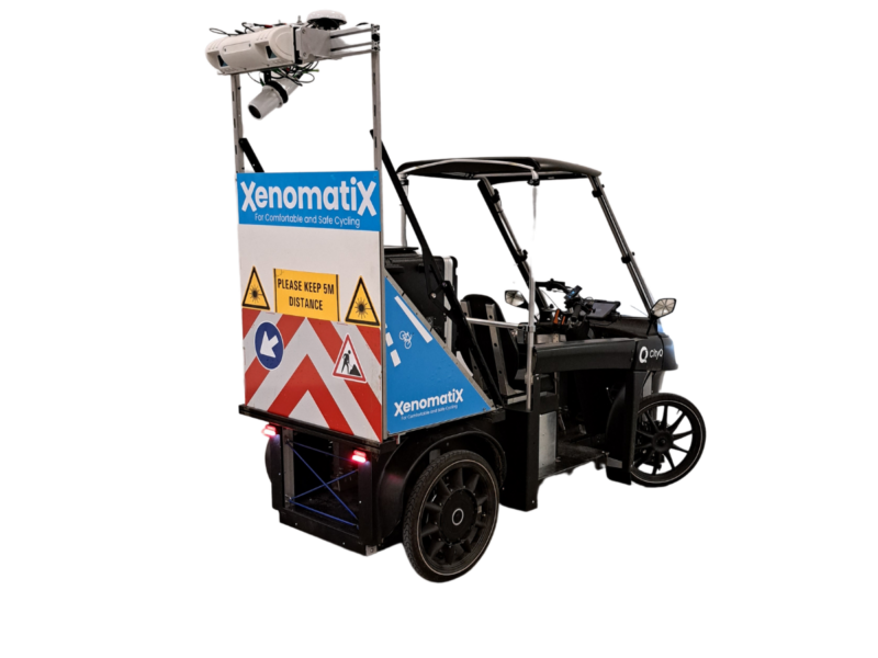
With that context established for how the road-monitoring system works for XenomatiX, Alaimo moved on to the XenoBike solution, which was introduced in the back half of 2023. Although the system is used for different applications, looking at the quality of bike lanes and sidewalks rather than roadways, the actual hardware system is essentially the same. Users can create the same kind of visualizations in GIS or PMS to determine the quality of the surveyed areas, and benefit from the same 6D qualities.
The difference lies in the vehicle that is used to collect the data, the XenoBike itself. This is a four-wheeled electric vehicle, but one that presents many benefits over a typical vehicle. For one thing, it qualifies as a bike as it has pedals and doesn’t exceed 15 mph, so users can legally utilize a bike lane rather than having to drive alongside it. The system allows for up to 140 kilometers to be captured per day, fit with swappable batteries and an ability to adjust measurement width up to four meters wide. And of course, fittingly given the goals of promoting easier alternative transportation methods, the XenoBike produces zero emissions, a major advantage over traditional car-based surveying.
Following this portion of the presentation, Geuens took over to speak briefly about some of the applications for this technology before both he and Alaimo answered questions from live listeners. In terms of applications, the company CEO spoke about how the XenoBike, and XenomatiX’s overall system, can be used for different types of areas. That includes bike lanes and roads, as mentioned, but also things like specifically inspecting bank angles on highways, which is crucial to know for water evacuation. Additionally, he noted how it’s been used to survey airport runways – both for the quality of the actual runway as well as surveying for debris which could potentially damage aircraft – along with race tracks and as a system to help test new vehicles.
This is just scratching the surface of the information shared on this webinar, detailing products that help crucial work done by surveyors around the world. To check out the entire presentation, you can register for free here.


