

In terms of technological timelines, we’ve had the ability to collect crucial data for understanding the world around us for quite some time. The sensors, other hardware, and software to gather this information hasn’t always been accessible, but even that is changing now as lidar sensors, as an example, become smaller and/or cheaper, while satellite data is much more readily available than before. However, it hasn’t always been very intuitive to analyze and gain insights from this data, in part because we haven’t had good ways to visualize it. Fortunately, that is changing rapidly thanks to new developments around digital twins and AI, often used in concert.
Today, we’re looking at three articles from friends around the industry talking about some of these better ways we have of fully understanding this data thanks to more intuitive visualization, among other reasons. First, we have an op-ed that looks at the value of digital twins and, more generally, “thinking spatially.” After that, we have coverage of a new AI model from a group of researchers out of Germany who are working to quickly create 3D maps from SAR imaging. Finally, we have a look back at a session from NVIDIA’s GTC conference looking at progress made with the Omniverse and OpenUSD. Find the full articles below.

The Hidden Dynamic of Digital Twin
Professor Freek Van Der Meer, Geospatial World
Here we have a guest post from Professor Freek Van Der Meer, the Dean of Faculty Geo-Information and Earth Observation at the University of Twente in the Netherlands. In the article, he talks about some of the recent advancements in artificial intelligence and machine learning, and how we have access to the kind of data necessary to create a digital twin of the Earth. He details what could be possible with this at our fingertips, who could potentially benefit from this digital twin, and the importance of a collaborative environment with all stakeholders contributing to and benefiting from the technology.
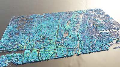
AI Generates 3D City Maps From Single Radar Images
Mark Harris, IEEE Spectrum
Being able to get accurate 3D maps of an area, particularly in the immediate aftermath of a natural disaster, would be immensely valuable for city governments. However, this is much easier said than done, with lidar surveys being expensive under normal conditions, and optical satellite imagery losing value with clouds or smoke in the air. A new AI-based framework, called SAR2Height, is able to solve that by creating a 3D map from a single SAR satellite. This article dives into the model, how it was created, what needs to happen before it can reliably be used by governments, and what kind of impact it could have.
The impressive progress of Omniverse and digital twins
Dean Takahashi, VentureBeat
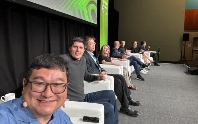
NVIDIA’s GTC is always one of the most prominent tech shows of the year, and that is only becoming more true as NVIDIA’s place in the industry only continues to grow. While their chips that are powering much of the current AI boom captured a lot of the attention at this year’s event, the Omniverse and OpenUSD was also a significant focus. In this article, Takahashi provides a transcript of a panel discussion he moderated at the show entitled Digitalizing the world’s largest industries with OpenUSD and generative AI. The panel included professionals from companies like Cesium, Microsoft, Siemens, and Amazon, among others, and touched on where we are today with industrial digital twins, and where there is to go from here.


