

It never really clicked for me until I was walking the floor of the EnergyOcean 2011 conference last week: Alternative Energy and 3D are a pretty great mix. Not only do alternative energy solutions need to bring to bear all of the best data to optimize the effectiveness of still-unproven ways of competing with fossil fuels, but these guys are also technological pioneers. They’re not going to be resistant to new methods of data capture and design. They’re going to embrace them.
Duh.
Sure, it’s easy to posit that good business people will embrace any technology that helps them make a buck, but I think most of you know that’s not the case. People are by nature somewhat conservative. They like to stick with the things that have made them successful in the first place, even if you’re making a good argument that you can make them more successful (and sometimes you’re not making that great of an argument, maybe, when you’re pushing new technology, but that’s a different discussion altogether). Some business people are more likely to jump in with both feet than others, though. If they’re already utilizing cutting-edge technology in one part of their business, or, better yet, their business is founded on utilizing new technology, then they’re likely to be more receptive to other new technology.
It’s not coincidence that tech companies are more likely to embrace social media and online advertising, for example. And it makes sense that software developers are more likely to use cloud-based collaboration tools like Bandcamp. It’s part of how their built as business people.
So, it makes sense that, walking the EnergyOcean floor, there was 3D all over the place. These guys are looking for an edge. As they make the argument that wind, tidal, and wave energy are realistic alternatives to fossil fuels they need to find every efficiency to that they can battle kilowatt for kilowatt. If 3D data capture can help them with that, they’re all over it. And the engineering firms that are looking to service those wind, tidal, wave pioneers aren’t dumb: They know to use their 3D skills as a marketing tool.
Check out this little selection of what the 10x10s looked like:
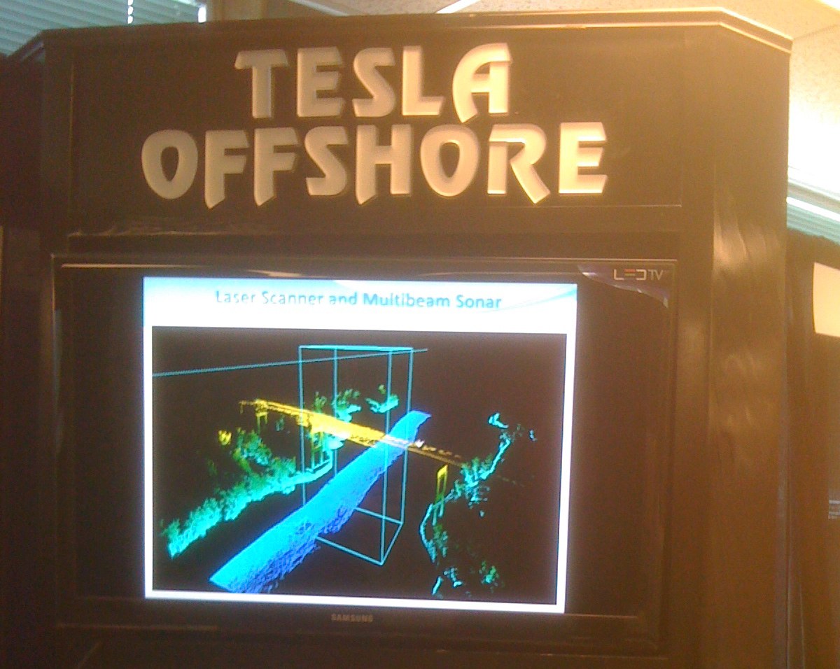
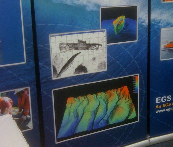
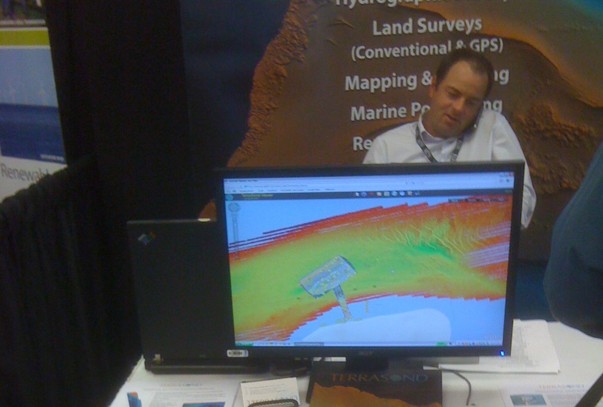
See, point clouds all over the place. And the 3D data capture was all over the map. Lots of multi-beam sonar, some 3d laser scanning, some use of lidar to map the wind, but the central theme was this: We want more good data to make more good decisions.
Since I was just walking the floor more out of curiosity than out of journalistic interest at the time (the EnergyOcean show was literally right across the street from the SPAR home offices, at the Holiday Inn here in Portland, Maine), I didn’t collect great notes, but here’s a quick run down of some companies I met and how they’re using 3D:
Tesla is doing a full line of 3D survey evaluation and design services, though a lot of that is sub-surface stuff. (Nor are they messing around, the 3D division is part of Tesla Conquest, which is kind of a bad-ass name for an offshore exploration firm.) But they’re also using laser scanning for QC and site evaluation.
Terrasond is a marine survey firm that has a very impressive array of technologies at their beck and call. They’re combining all of that to tackle the surveying and mapping market on the water and around the shores of the Pacific Northwest, reaching up into Alaska (where they’re based), along with Rio, Corpus Christi, and Equatorial Guinea. They sport a Leica HDS6100 and a Riegl 2D amongst their arsenal. They’ve got a nice collection of workboats rigged up, that’s for sure.
EGS Survey is a large firm focusing on marine-based survey and construction support. Looks like they’re mostly using sonar for their 3D imaging when working on marine geophysical surveys at the moment, but they like to show off their work in 3D.
Fugro is a very large engineering firm, and they’ve embraced 3D whole-heartedly. Their terrestrial survey division owns a mobile mapping vehicle. And they’ve been on board with airborne lidar since at least 2004.
Sewall, a firm doing geospatial, engineering, and natural resource consulting (and the oldest surveying firm in Maine), based right here in Old Town, Maine, is using lidar in their work to support wind farm development.
Sgurr Energy is doing some really cool work in using lidar to map the wind, and thus help with the placement of wind turbines.
SGC Engineering, which was recently bought by Senergy Alternative Energy, and has offices right here in Westbrook, Maine, is using lidar in their transmission line work.
Obviously, this is just a small sampling of the capabilities on display, but for a conference ostensibly focusing on alternative energy derived from the world’s oceans, there was an awful lot of talk about 3D on the show floor. Just another indication that this is a technology poised to become vital to any number of workflows and projects.


